Worle
EngvarB from October 2013Former civil parishes in SomersetVillages in North SomersetWeston-super-Mare
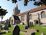
Worle ( WURL) is a large village in North Somerset which is joined to the seaside town of Weston-super-Mare on its western edge. It, however, maintains a very separate identity, and may now be bigger than its more famous neighbour. Worle pre-dates Weston and was mentioned in the Domesday Book of 1086. In the book, it is said that Worle was owned by Walter of Douai, and consisted of 750 acres (3.0 km2) and valued at 6.5 hides. "Walter of Douai holds of the King, Worle. Edgar held it in the time of King Edward, and gelded for six hides and a half." The parish church of St Martin's sits on the side of Worlebury Hill and overlooks the village.
Excerpt from the Wikipedia article Worle (License: CC BY-SA 3.0, Authors).Worle
Greenwood Road,
Geographical coordinates (GPS) Address Phone number Website Nearby Places Show on map
Geographical coordinates (GPS)
| Latitude | Longitude |
|---|---|
| N 51.3578 ° | E -2.9277 ° |
Address
Mendip Green Primary School
Greenwood Road
BS22 6EX , Weston Village
England, United Kingdom
Open on Google Maps


