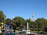
Barbaros Boulevard

The Barbaros Boulevard (Turkish: Barbaros Bulvarı) is a 3.1 km (1.9 mi)-long major street in the Beşiktaş district on the European side of Istanbul, Turkey. It runs in a straight line in south–north direction from Beşiktaş Square over Yıldız up to Zincirlikuyu, where it passes over to Büyükdere Avenue. It is named after the Ottoman admiral of the fleet Hayreddin Barbarossa (Turkish: Barbaros Hayrettin Paşa) (c. 1478–1546), whose tomb is located in Beşiktaş. It is a major artery of the Istanbul Central Business District, which is not located in the historic center of the city, but rather north of Taksim Square.The 1.5 km (0.93 mi) long boulevard ascends a slope from 1.5 m (4.9 ft) elevation at Beşiktaş Square up to 135 m (443 ft) at Balmumcu before Zincirlikuyu. This part of the street is 50 m (160 ft) wide with a slope gradient of 8%, while the part between Balmumcu and Zincirlikuyu has a width of 30 m (98 ft) and a slope gradient of 2–3%.
Excerpt from the Wikipedia article Barbaros Boulevard (License: CC BY-SA 3.0, Authors, Images).Barbaros Boulevard
Barbaros Bulvarı,
Geographical coordinates (GPS) Address Nearby Places Show on map
Geographical coordinates (GPS)
| Latitude | Longitude |
|---|---|
| N 41.0547 ° | E 29.0094 ° |
Address
Ertuğrul Blokları 4
Barbaros Bulvarı
34349 (Dikilitaş Mahallesi)
Türkiye
Open on Google Maps


