place

Soco Gap

Blue Ridge ParkwayLandforms of Haywood County, North CarolinaLandforms of Jackson County, North CarolinaMountain passes of North CarolinaNorth Carolina geography stubs
Qualla BoundaryTransportation in Haywood County, North CarolinaTransportation in Jackson County, North CarolinaU.S. Route 19
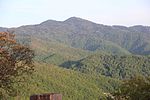
Soco Gap 2014
Soco Gap 2014

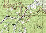
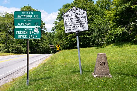
Soco Gap (el. 4,340 ft (1,320 m)) is a mountain pass between the Plott Balsams to the south and the Great Balsam Mountains to the north. The gap is the eastern point of the Qualla Boundary, which marks the territory held as a land trust for the federally recognized Eastern Band of Cherokee Indians. The gap separates Haywood and Jackson counties and separates the river basins to the French Broad River and the Little Tennessee River. In Cherokee, the pass is known as Ahalunun'yi (ᎠᎭᎷᏄn'Ᏹ), meaning "Ambush Place" or Uni'halu'na (ᎤᏂ'ᎭᎷ'Ꮎ), meaning "where they ambushed;" named after the occasion, probably in the mid-18th century, when the Cherokees ambushed a party of invading Shawnees, all of which were killed except for one, who was sent back (without his ears) to tell his people of the Cherokee victory. U.S. Route 19 (Soco Road) traverses through the gap, which connects Cherokee and Maggie Valley. The Blue Ridge Parkway also passes through the gap, providing scenic views along the adjacent ridge lines.

Excerpt from the Wikipedia article Soco Gap (License: CC BY-SA 3.0, Authors, Images).

Geographical coordinates (GPS)

Latitude Longitude
N 35.4953793 ° E -83.1562552 °
placeShow on map

Address

Soco Road

Soco Road

North Carolina, United States
mapOpen on Google Maps

Soco Gap 2014
Soco Gap 2014
Share experience

Nearby Places

Jackson Community School

The Jackson Community School is an alternative school in Jackson County, North Carolina for grades K–12 which serves students who need a smaller setting to access scholastic success. It seeks to serve all students with individualized attention built on trauma informed practices and seeks to prepare all graduates for employment, enrollment, or enlistment. It opened in the old Scotts Creek School, built in 1951, in 2002 after the new Scotts Creek Elementary School opened in 2001. The building received several renovations when it was converted into the HUB. It is the oldest school building still in use as a school in the county. It is located on old US 19/23 in the Addie Community and the campus borders Scotts Creek. When it opened it was a state-of-the-art facility, and didn't require blinds because the building was positioned at such an angle that the sun would always be overhead and would never directly shine into the classrooms windows. The building has two floors on the backside and one floor on the front. A small addition was added to the middle section of the school in the 1970s or 1980s. The Gym/Auditorium is small by modern standards, as the sideline was the wall. The new school that replaced Scotts Creek has a separate Gym and Auditorium, both of which are relatively large when compared to the old Gym/Auditorium. The school is the smallest school in the district and it is also one of the most recently established.