Amsterdam Ordnance Datum or Normaal Amsterdams Peil (NAP) is a vertical datum in use in large parts of Western Europe. Originally created for use in the Netherlands, its height was used by Prussia in 1879 for defining Normalnull, and in 1955 by other European countries. In the 1990s, it was used as the reference level for the United European leveling Network (UELN) which in turn led to the European Vertical Reference System (EVRS).Mayor Johannes Hudde of Amsterdam in a way came up with the idea after he expanded the sea dike after a flood in Amsterdam in 1675. Of course a dike should be storm-resistant to protect a city against flooding, and in this case a margin of "9 feet and 5 inches" (2.67 m - margin is defined in Amsterdam feet) was deemed enough to cope with rising water. So he measured the water level of the adjacent sea arm, Het IJ and compared it with the water level in the canals within the city itself. He found that the water level at an average summer flood in the sea arm (when the water level reaches its maximum, not counting storms) was about the same as the level on the other side of the sea-dike, plus the margin of 9 feet and 5 inches. The relatively constant water level in the canals of Amsterdam, called Amsterdams Peil ("Amsterdam level", AP), equalled the level at summer flood at sea in the sea-inlet, which changes throughout the year. AP was carried over to other areas in the Netherlands in 1860, to replace locally used levels. In this operation, an error was introduced which was corrected (normalised) between 1885 and 1894, resulting in the Normaal Amsterdams Peil.
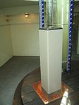
Originally the zero level of NAP was the average summer flood water level in the IJ just north of the centre of Amsterdam (which was at the time, in 1684, the main shipping area, then still connected with the open sea). Currently it is physically realised by a brass benchmark on a 22-meter pile below the Dam square in Amsterdam. The brass benchmark in the Amsterdam Stopera (combined city hall and opera house), which is a tourist attraction, is no longer used as a reference point.


