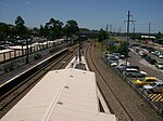
Tuggerah

Tuggerah () is a large commercial hub and a suburb of the Central Coast region of New South Wales, Australia. Tuggerah is situated on the Main North Railway Line and Pacific Motorway, and is located approximately 91 km north of Sydney and 68 km south of Newcastle. It is the second largest business hub, major shopping area and financial district for the Central Coast after Erina.It is a mixture of semi-rural, residential, and light industrial. Historically it was, like much of the Wyong District, a dairy area, and still has the Pioneer Dairy Wetlands. There was an airstrip for some years which has now been built over. The Wyong South sewerage plant is also located in Tuggerah. Tuggerah is located in the Central Coast Council local government area.
Excerpt from the Wikipedia article Tuggerah (License: CC BY-SA 3.0, Authors, Images).Tuggerah
McDonagh Road, Central Coast Council
Geographical coordinates (GPS) Address Website Nearby Places Show on map
Geographical coordinates (GPS)
| Latitude | Longitude |
|---|---|
| N -33.299 ° | E 151.435 ° |
Address
Central Coast Wetlands (Pioneer Dairy)
McDonagh Road
2259 Central Coast Council
New South Wales, Australia
Open on Google Maps


