place

Giles Conservation Park

2007 establishments in AustraliaConservation parks of South AustraliaIUCN Category IIIProtected areas established in 2007Use Australian English from April 2014

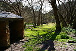
Giles Conservation Park is a protected area in the Australian state of South Australia located approximately 10 km (6.2 mi) east of the state capital of Adelaide. It was declared in 2007 and has an area of 109 ha (270 acres). Previously, the land was the eastern portion of the Horsnell Gully Conservation Park. It was named after the family of Charles Giles who is reported as being a pioneer in the fields of horticulture and floriculture in South Australia.The conservation park features remnant native vegetation and native animals such as Western grey kangaroos and koalas. It features one walking trail that is part of the Mount Lofty to Norton Summit portion of the Heysen and Yurrebilla trails. The official brochure suggests that the conservation park offers ‘excellent opportunities for bushwalking, birdwatching, photography, painting and nature study."The conservation park is classified as an IUCN Category III protected area.

Excerpt from the Wikipedia article Giles Conservation Park (License: CC BY-SA 3.0, Authors).

Giles Conservation Park
Vineyard Track, Adelaide Hills Council

Geographical coordinates (GPS) Address External links Nearby Places
placeShow on map

Wikipedia: Giles Conservation ParkContinue reading on Wikipedia

Geographical coordinates (GPS)

Latitude Longitude
N -34.934556944444 ° E 138.72255277778 °
placeShow on map

Address

Giles Conservation Park

Vineyard Track
5137 Adelaide Hills Council (Horsnell Gully)
South Australia, Australia
mapOpen on Google Maps

linkWikiData (Q16840090)
linkOpenStreetMap (582162)

Share experience

Nearby Places

Horsnell Gully Conservation Park

Horsnell Gully Conservation Park (formerly Horsnell Gully National Park) is a protected area in the Australian state of South Australia in the locality of Horsnell Gully located about 9 kilometres (5.6 mi) east of the state capital of Adelaide and about 2.3 kilometres (1.4 mi) southwest of Norton Summit.It contains several small gorges feeding the Adelaide Plains, a small seasonal waterfall and a number of walking trails including one that is part of the Heysen Trail. It adjoins the Giles Conservation Park which was formerly the conservation park's upper eastern section.The conservation park consists of land in sections 609 and 618 in the cadastral unit of the Hundred of Adelaide.Land within the conservation park having an area of 1.14 square kilometres (282 acres) first gained protected status as a national pleasure resort during 1947 and prior to 6 August 1947. On 7 March 1963, section 609 was dedicated as part of a wildlife reserve proclaimed under the Crown Lands Act 1929. On 9 November 1967, all of the land was proclaimed under the National Parks Act 1966 as the Horsnell National Park. The national park was re-proclaimed under the National Parks and Wildlife Act 1972 as Horsnell Conservation Park on 27 April 1972. On 28 November 1985, land in sections 1118 and 1119 of the Hundred of Adelaide was added to the conservation park. On 30 August 2007, the land added in 1985 was separately constituted as the Giles Conservation Park. As of 2018, it covered an area of 1.37 square kilometres (0.53 sq mi).The entirety of the conservation park is now leased from the government on a monthly basis for industrial purposes by the neighbouring White Rock Quarry, owned by the German based multinational company, Heidelberg Cement Group. 10 acres of conservation park land have been cleared and used for stockpiling and dumping of old machinery and vehicles. The water from Horsnell Conservation Park Dam is also used by the company for the manufacturing of concrete. There is a community group, Residents Against White Rock Quarry who are campaigning for the termination of this lease. In 1980, the park was described as follows: Covering the western slopes of the Mount Lofty ranges due east of Adelaide, Horsnell Gully Conservation Park encompasses an area of rugged terrain. It forms part of the watershed of Third Creek, one of the five main tributaries of the River Torrens. Plant communities are represented by stringybark associations with Sclerophyllous understories and the smoothbark (Eucalyptus camaldulensis, E viminalis and E leucoxylon) associations on more fertile soils at lower elevations. A Savannah understorey of alien pasture plants with some shrubs is a feature of this area. It is classified as an IUCN Category III protected area. In 1980, the conservation park was listed on the former Register of the National Estate.

Teringie, South Australia

Teringie is a suburb of Adelaide in South Australia. It occupies a commanding position in the Adelaide Hills and overlooks the plains on which most of the city is built. Teringie's small number of houses (less than 100 in total) are mostly large, bush-covered blocks. The suburb is steadily growing with new houses popping up continually.A large portion of the land was originally owned by RM Williams, remains of his original brick factory still form part of a residential property on Norton Summit Road, the now subdivided blocks still owned by descendants of RM Williams. Other previous notable residents include: Giuseppe Capogreco arrived in Australia in 1955 from Italy and purchased a parcel of land in Teringie for his wine making ventures. Capogreco's wines were initially produced for distribution within the local community, but as word of mouth spread over the years, the wine's reputation spread far and wide, and supply succumbed to the limits of production. Vinyards are still present and operating in the area today under the Teringie Estate Wines banner which has branched as far as China. Harry Clisby – an engineer who's designs inspired Ferrari and assisted Jack Brabham's Formula One success. Mr Clisby built a large medieval castle style residence which included a miniature railway, almost rolercoaster. Mr Clisby built most of the residence himself which took over 15 years to complete. Teringie was originally a private subdivision. The name was approved in 1978 by the Geographical Names Board in lieu of the original proposal of Teringie Heights following the stated preference of the local council. The name is of Aboriginal origin meaning place of beautiful birds. (Citation required please) The western end of the suburb comprises some higher density housing with still most residences being large and situated on larger than average land parcels. The further eastern part comprises mostly the larger bushland covered blocks some of which run into the large valleys. The suburb is bordered to the north by Morialta Conservation Park and the south by suburbs, Norton Summit, Horsnell Gully, Skye and Auldana. The notable power lines running overhead have created some controversy as some believe that they are detrimental to health. Teringie is serviced by the East Torrens CFS – Ashton brigade. A wealth of wildlife exists close by: koalas, kangaroos, possums, echidnas, and a great variety of birdlife including yellow-tail and red-tail black cockatoos. For injured wildlife please call volunteer organisation 1300 KOALAZ (562 529).