place

Uraidla, South Australia

Adelaide HillsTowns in South AustraliaUse Australian English from June 2013
Uraidla
Uraidla

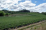
Uraidla (, yoo-RAYD-lə) is a small town in the Adelaide Hills of South Australia, Australia. At the 2016 census, Uraidla had a population of 575. However it also sits at the centre of a larger population catchment of rural townships which include Summertown, Piccadilly, Ashton, Basket Range, Carey Gully, Norton Summit and Cherryville. The name is derived from the Kaurna name Yuridla, which means "two ears" and originally referred to the two nearby peaks of Mt Lofty and Mt Bonython, and also relates to the Dreaming story of Ngarnu, a giant from the east.

Excerpt from the Wikipedia article Uraidla, South Australia (License: CC BY-SA 3.0, Authors, Images).

Uraidla, South Australia
Cornish Road, Adelaide Hills Council

Geographical coordinates (GPS) Address Nearby Places
placeShow on map

Wikipedia: Uraidla, South AustraliaContinue reading on Wikipedia

Geographical coordinates (GPS)

Latitude Longitude
N -34.95 ° E 138.73333333333 °
placeShow on map

Address

Cornish Road

Cornish Road
5141 Adelaide Hills Council, Summertown
South Australia, Australia
mapOpen on Google Maps

Uraidla
Uraidla
Share experience

Nearby Places

Carey Gully
Carey Gully

Carey Gully is a small town in the Adelaide Hills region of South Australia. The name of the town is taken from one of the early settlers of the area, Paddy Carey, and was originally called Carey's Gully, (This can be seen at the town's War Memorial on a wrought iron sign). Whilst being named a "gully" the present township actually straddles part of the Mount Lofty Ranges, separating the valley townships of Uraidla to the west and Balhannah to the east. The older settlements in Carey Gully are located down smaller gullies where soil was suitable for agriculture. Recent decades have seen the decline of the Carey Gully township, with the closure of the general store which also sold petrol. Still in operation are the Country Fire Service station, the Carey Gully Quarry and a small scale factory building on Deviation Road, housing a boat-building business and a traditional carpenter among others. Greenhill Road is the main route through the town, upon which the hub of the township is located, but in the past much of the town's major establishments were located on adjacent Deviation Road. The road was an ideal location for the township in the past as it was situated on a largely dry, flat area (compared to the steep hills surrounding) and was also a main thoroughfare to the towns of Forest Range and Lenswood via Boundary Drive. Deviation Road once hosted a Football oval (Australian Rules Football) and tennis courts (now a strawberry field), and a general store which still stands to this day, but is currently a private residence. The decline of the town has seen it become a much more quiet, idyllic location, attracting people from nearby Adelaide. The location of Carey Gully makes it cool in summer and provides brilliant views and cool, isolated valleys to those seeking a weekend getaway or quiet retirement. Agriculture is the main industry with crops of strawberries, apples, cherries and wine grapes being grown. Along with this there are various hobby farms throughout the area running livestock such as goats, sheep, cattle, and deer. Although much of the land is devoted to agriculture, as with many towns in the Adelaide Hills, Carey Gully has retained a large portion of its natural bushland which boasts many species of threatened and endangered flora and fauna, Wotton's Scrub and White's Scrub (part of the Kenneth Stirling Conservation Park) being excellent examples. Carey Gully has been affected many times by bushfire, most notably the Ash Wednesday fires in 1983. Public transport to Carey Gully is provided by the Adelaide Metro. Routes 821 & 822 provide a service to and from the City approximately every 2 hours, with route 822 also providing a link to nearby Stirling. More services to and from the city are provided at peak times.

Horsnell Gully Conservation Park

Horsnell Gully Conservation Park (formerly Horsnell Gully National Park) is a protected area in the Australian state of South Australia in the locality of Horsnell Gully located about 9 kilometres (5.6 mi) east of the state capital of Adelaide and about 2.3 kilometres (1.4 mi) southwest of Norton Summit.It contains several small gorges feeding the Adelaide Plains, a small seasonal waterfall and a number of walking trails including one that is part of the Heysen Trail. It adjoins the Giles Conservation Park which was formerly the conservation park's upper eastern section.The conservation park consists of land in sections 609 and 618 in the cadastral unit of the Hundred of Adelaide.Land within the conservation park having an area of 1.14 square kilometres (282 acres) first gained protected status as a national pleasure resort during 1947 and prior to 6 August 1947. On 7 March 1963, section 609 was dedicated as part of a wildlife reserve proclaimed under the Crown Lands Act 1929. On 9 November 1967, all of the land was proclaimed under the National Parks Act 1966 as the Horsnell National Park. The national park was re-proclaimed under the National Parks and Wildlife Act 1972 as Horsnell Conservation Park on 27 April 1972. On 28 November 1985, land in sections 1118 and 1119 of the Hundred of Adelaide was added to the conservation park. On 30 August 2007, the land added in 1985 was separately constituted as the Giles Conservation Park. As of 2018, it covered an area of 1.37 square kilometres (0.53 sq mi).The entirety of the conservation park is now leased from the government on a monthly basis for industrial purposes by the neighbouring White Rock Quarry, owned by the German based multinational company, Heidelberg Cement Group. 10 acres of conservation park land have been cleared and used for stockpiling and dumping of old machinery and vehicles. The water from Horsnell Conservation Park Dam is also used by the company for the manufacturing of concrete. There is a community group, Residents Against White Rock Quarry who are campaigning for the termination of this lease. In 1980, the park was described as follows: Covering the western slopes of the Mount Lofty ranges due east of Adelaide, Horsnell Gully Conservation Park encompasses an area of rugged terrain. It forms part of the watershed of Third Creek, one of the five main tributaries of the River Torrens. Plant communities are represented by stringybark associations with Sclerophyllous understories and the smoothbark (Eucalyptus camaldulensis, E viminalis and E leucoxylon) associations on more fertile soils at lower elevations. A Savannah understorey of alien pasture plants with some shrubs is a feature of this area. It is classified as an IUCN Category III protected area. In 1980, the conservation park was listed on the former Register of the National Estate.