Nordstrand, Germany

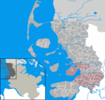
(North Frisian: di Ströön) is a peninsula and former island in North Frisia on the North Sea coast of Germany. It is part of the Nordfriesland district in the federal state of Schleswig-Holstein. Its area is 50 km² and its population is 2,300. Nordstrand has two municipalities, Nordstrand and smaller Elisabeth-Sophien-Koog, which are part of the Amt Nordsee-Treene. In medieval times Nordstrand was a part of the larger island of Strand, which was torn into pieces in a disastrous storm tide in 1634. More than 6,000 people drowned. Before 1634 the area of the island was about 210 square miles (540 km2). Other remnants of Strand are Pellworm and some Halligen islets. Similar storm surge destruction occurred in 1362 when the town of Rungholt and 28 churches (out of 59 at that time) with the associated villages perished Nordstrand is accessible by road over a causeway, which connects to the mainland and was built in 1936. In 1987 the polder Beltringharder Koog was completed, turning the former island into a peninsula.
Excerpt from the Wikipedia article Nordstrand, Germany (License: CC BY-SA 3.0, Authors, Images).Nordstrand, Germany
Neukoogstraße, Nordsee-Treene
Geographical coordinates (GPS) Address Nearby Places Show on map
Geographical coordinates (GPS)
| Latitude | Longitude |
|---|---|
| N 54.483333333333 ° | E 8.8833333333333 ° |
Address
Neukoogstraße 1a
25845 Nordsee-Treene
Schleswig-Holstein, Germany
Open on Google Maps


