Nether Haddon
Derbyshire DalesDerbyshire geography stubsTowns and villages of the Peak DistrictVillages in Derbyshire

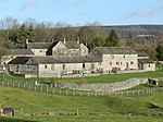
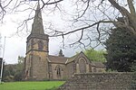
Nether Haddon is a sparsely populated village and civil parish in Derbyshire, England. It is immediately downstream along the River Wye from the small town of Bakewell and much of its land is owned by Haddon Hall, a medieval and Tudor building largely rendered in stone. The population of the village is included in the civil parish of Over Haddon.
Excerpt from the Wikipedia article Nether Haddon (License: CC BY-SA 3.0, Authors, Images).Nether Haddon
A6, Derbyshire Dales Nether Haddon CP
Geographical coordinates (GPS) Address Nearby Places Show on map
Geographical coordinates (GPS)
| Latitude | Longitude |
|---|---|
| N 53.192 ° | E -1.652 ° |
Address
Haddon Hall Car Park
A6
DE45 1LA Derbyshire Dales, Nether Haddon CP
England, United Kingdom
Open on Google Maps


