place

High Littleton

Civil parishes in SomersetSomerset coalfieldUse British English from July 2012Villages in Bath and North East Somerset
High Littleton (Somerset) Holy Trinity Church geograph.org.uk 67726

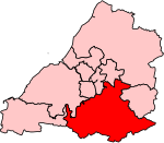
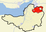
High Littleton is a village and civil parish in Somerset, England, about 1.2 miles (1.9 km) north of Paulton and 7.5 miles (12 km) south-west of Bath. The parish includes the small village of Hallatrow and the hamlets of White Cross, Greyfield and Mearns; the northeastern part of High Littleton village is known as Rotcombe. High Littleton and Hallatrow are on the A39 Wells-Bath road, which is crossed by the A37 Shepton Mallet to Bristol road at White Cross. There is a Church of England Voluntary Controlled primary school (4–11 years) in the village, together with several pubs and shops.

Excerpt from the Wikipedia article High Littleton (License: CC BY-SA 3.0, Authors, Images).

High Littleton
High Street, Bristol

Geographical coordinates (GPS) Address Website Nearby Places
placeShow on map

Wikipedia: High LittletonContinue reading on Wikipedia

Geographical coordinates (GPS)

Latitude Longitude
N 51.324 ° E -2.511 °
placeShow on map

Address

Spar

High Street
BS39 6JD Bristol
England, United Kingdom
mapOpen on Google Maps

Website
spar.co.uk

linkVisit website

High Littleton (Somerset) Holy Trinity Church geograph.org.uk 67726
Share experience

Nearby Places

Church of the Holy Trinity, Paulton

The Anglican Church of the Holy Trinity in Paulton, Somerset, England, was founded in 1235 and is a Grade II* listed building. It was built on the site of an earlier church. The Church of the Trinity is located in the parish of Paulton and Diocese of Bath and Wells, having previously been a chapel attached to the Church of St Mary Magdalene in Chewton Mendip until 1841. Paulton is currently serving as part of the 10 lamps ministry group and is part of the benefice with St John's, Farrington Gurney, and Holy Trinity, High Littleton.The church was rebuilt in 1757 and restored in 1839 by John Pinch, to cope with the growing population working on the Somerset coalfield. The chancel and organ chamber were added in 1864. Two stone effigies which are believed to be of members of the Palton family after which the village is named. The three-stage square tower was built in the reign of Edward III and stands at the west end of north aisle of church. It was refaced in 1757 with stone from the Doulting Stone Quarry. The bells were recast by the Bilbie family in 1742 and a sixth bell was added in 1897 to commemorate the sixtieth anniversary of Queen Victoria. The clock was added in 1872.The churchyard includes a cholera monument, to 23 men, 23 women and 26 children who died in a cholera outbreak in 1832 and 14 men, 14 women and 34 children from a second outbreak between 1844 and 1850. There are several other monuments in the churchyard.

Paulton
Paulton

Paulton (English: ) is a large village and civil parish, with a population of 5,302, located to the north of the Mendip Hills, very close to Norton Radstock in the unitary authority of Bath and North East Somerset (BANES), England. Paulton is a former coal mining village and the terminus of the Somerset Coal Canal is at Paulton basin, just north of the village. Paulton was home to the now-closed Polestar Purnells printing factory and Ashman's boot factory, where 'Voidax' safety footwear was manufactured, and in particular Motorcycle speedway boots. The area has been designated as an 'area of special architectural or historic interest, the character or appearance of which it is desirable to preserve or enhance' under section 69 of the Planning (Listed Buildings and Conservation Areas) Act 1990.Paulton has a small hospital, doctors surgery, dentist, chemist, nursing home, library, public swimming pool, newsagent, travel agent, two convenience stores, a filling station, three takeaways, fire station, two pre-schools (Noahs Ark Preschool and Acorn Preschool), an infant school, and a junior school]. The village is also served by a nearby supermarket. There are two pubs in the village: The Red Lion and The Lamb. A licensed bar and restaurant: La Campagna was previously a public house known as The Winterfield Inn (which closed in 2015). Until the mid-1980s, there was also The Queen Victoria, but this was demolished to make way for flats, and The Somerset Inn which closed in 2011, with the adjoining paddock the subject of an unsuccessful planning application since, which would have seen it turned into a 22 home housing estate. There are also two members' clubs in the village, Paulton Rovers F.C. and Greyfield's Sports and Social club. The centre of the village is the location for the war memorial and a small library. There is another war memorial just outside the village, to the southwest, which commemorates the location where 23 men were killed on 17 September 1944 when the glider they were flying in crashed en route from R.A.F. Keevil to Arnhem, as part of Operation Market Garden.