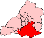
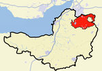
Paulton

Paulton (English: ) is a large village and civil parish, with a population of 5,302, located to the north of the Mendip Hills, very close to Norton Radstock in the unitary authority of Bath and North East Somerset (BANES), England. Paulton is a former coal mining village and the terminus of the Somerset Coal Canal is at Paulton basin, just north of the village. Paulton was home to the now-closed Polestar Purnells printing factory and Ashman's boot factory, where 'Voidax' safety footwear was manufactured, and in particular Motorcycle speedway boots. The area has been designated as an 'area of special architectural or historic interest, the character or appearance of which it is desirable to preserve or enhance' under section 69 of the Planning (Listed Buildings and Conservation Areas) Act 1990.Paulton has a small hospital, doctors surgery, dentist, chemist, nursing home, library, public swimming pool, newsagent, travel agent, two convenience stores, a filling station, three takeaways, fire station, two pre-schools (Noahs Ark Preschool and Acorn Preschool), an infant school, and a junior school]. The village is also served by a nearby supermarket. There are two pubs in the village: The Red Lion and The Lamb. A licensed bar and restaurant: La Campagna was previously a public house known as The Winterfield Inn (which closed in 2015). Until the mid-1980s, there was also The Queen Victoria, but this was demolished to make way for flats, and The Somerset Inn which closed in 2011, with the adjoining paddock the subject of an unsuccessful planning application since, which would have seen it turned into a 22 home housing estate. There are also two members' clubs in the village, Paulton Rovers F.C. and Greyfield's Sports and Social club. The centre of the village is the location for the war memorial and a small library. There is another war memorial just outside the village, to the southwest, which commemorates the location where 23 men were killed on 17 September 1944 when the glider they were flying in crashed en route from R.A.F. Keevil to Arnhem, as part of Operation Market Garden.
Excerpt from the Wikipedia article Paulton (License: CC BY-SA 3.0, Authors, Images).Paulton
The Pithay,
Geographical coordinates (GPS) Address Nearby Places Show on map
Geographical coordinates (GPS)
| Latitude | Longitude |
|---|---|
| N 51.3069 ° | E -2.5027 ° |
Address
The Hub
The Pithay 1-2
BS39 7QG
England, United Kingdom
Open on Google Maps


