place

Engelmann Peak

Arapaho National ForestColorado geography stubsMountains of Clear Creek County, ColoradoMountains of ColoradoNorth American 4000 m summits
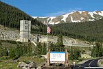
Engelmann Peak viewed from Berthoud Pass, July 2016

Engelmann Peak is a high mountain summit in the Front Range of the Rocky Mountains of North America. The 13,368-foot (4,075 m) thirteener is located in Arapaho National Forest, 6.3 miles (10.2 km) west by south (bearing 261°) of the Town of Empire in Clear Creek County, Colorado, United States. The mountain was named in honor of the botanist George Engelmann.The mountain is named for George Engelmann (1809-1884) a famous botanist responsible for describing and naming flora in the Rocky Mountains. He was born and educated in Germany and received his medical degree there. In 1832, he sailed to America. His financial backing had come from relatives in Germany who wanted him to invest in the lands of the new country so he explored areas in Illinois, Missouri and Arkansas.

Excerpt from the Wikipedia article Engelmann Peak (License: CC BY-SA 3.0, Authors, Images).

Geographical coordinates (GPS)

Latitude Longitude
N 39.7455426 ° E -105.8005636 °
placeShow on map

Address

Clear Creek County (Clear Creek)


Colorado, United States
mapOpen on Google Maps

Engelmann Peak viewed from Berthoud Pass, July 2016
Share experience

Nearby Places

Berthoud Pass
Berthoud Pass

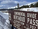
Berthoud Pass ( BURTH-əd; elevation 11,307 ft (3,446 m)) is a high mountain pass in central Colorado, in the Front Range of the Rocky Mountains of the western United States. The pass is located west of Denver, and provides a high route between upper Clear Creek Canyon to the upper valley of the Fraser River in Middle Park to the north. It traverses the continental divide at the Front Range, on the border between Clear Creek County and Grand County. The pass is named for Edward L. Berthoud, the chief surveyor of the Colorado Central Railroad during the 1870s. Accompanied by Jim Bridger, Berthoud discovered the pass in July 1861 while surveying a possible route for the railroad. Berthoud concluded that the pass was suitable as a wagon road, but not as a railroad, and was then hired by the Central Overland California and Pikes Peak Express Company to survey a route over the pass to Salt Lake.The route of U.S. Highway 40 currently traverses the pass north of its junction with Interstate 70 in Clear Creek Canyon. It provides primary road access to Winter Park and a secondary route to Steamboat Springs from Denver and the Colorado Front Range. However, the pass is one of the most notoriously difficult passes in Colorado for motorists, based on its height as well as the steep grades on both sides (6.3%) and the large number of switchbacks on the southern side of the pass. At least 55 avalanche paths have been mapped on Berthoud Pass, some of them intersecting U.S. Highway 40 and some of those intersecting the roadway at multiple points on the pass. In 2015, CDOT installed an automated propane-fueled avalanche mitigation system consisting of five units that create concussive blasts to mitigate snow slab buildup on avalanche path #5, Stanley.