place

Alki Point, Seattle

Chinook Jargon place namesElliott BayHeadlands of Washington (state)Landforms of King County, WashingtonLandforms of Seattle
Neighborhoods in SeattleWashington placenames of Native American originWest Seattle, Seattle
West Seattle with Elliott Bay and Downtown Seattle

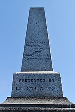
Alki Point (, Lushootseed: sbaqʷabqs, lit. 'prairie point') is a point jutting into Puget Sound, the westernmost landform in the West Seattle district of Seattle, Washington. Alki is the peninsular neighborhood on Alki Point. Alki was the original settlement in what was to become the city of Seattle. It was part of the city of West Seattle from 1902 until that city's annexation by Seattle in 1907. The Alki neighborhood extends along the shore from the point, both southeast and northeast. To the northeast it continues past Alki Beach roughly to Duwamish Head, the northernmost point of West Seattle. Alki Point also marks the southern extent of Elliott Bay; a line drawn northwest to West Point marks the division between bay and sound.

Excerpt from the Wikipedia article Alki Point, Seattle (License: CC BY-SA 3.0, Authors, Images).

Alki Point, Seattle
Point Place Southwest, Seattle

Geographical coordinates (GPS) Address Nearby Places
placeShow on map

Wikipedia: Alki Point, SeattleContinue reading on Wikipedia

Geographical coordinates (GPS)

Latitude Longitude
N 47.576 ° E -122.42 °
placeShow on map

Address

Point Place Southwest
98116 Seattle
Washington, United States
mapOpen on Google Maps

West Seattle with Elliott Bay and Downtown Seattle
Share experience

Nearby Places

Puget Sound
Puget Sound

Puget Sound () is a sound of the Pacific Northwest, an inlet of the Pacific Ocean, and part of the Salish Sea. It is located along the northwestern coast of the U.S. state of Washington. It is a complex estuarine system of interconnected marine waterways and basins, with one major and two minor connections to the open Pacific Ocean via the Strait of Juan de Fuca—Admiralty Inlet being the major connection and Deception Pass and Swinomish Channel being the minor. Water flow through Deception Pass is approximately equal to 2% of the total tidal exchange between Puget Sound and the Strait of Juan de Fuca. Puget Sound extends approximately 100 miles (160 km) from Deception Pass in the north to Olympia in the south. Its average depth is 450 feet (140 m) and its maximum depth, off Jefferson Point between Indianola and Kingston, is 930 feet (280 m). The depth of the main basin, between the southern tip of Whidbey Island and Tacoma, is approximately 600 feet (180 m).In 2009, the term Salish Sea was established by the United States Board on Geographic Names as the collective waters of Puget Sound, the Strait of Juan de Fuca, and the Strait of Georgia. Sometimes the terms "Puget Sound" and "Puget Sound and adjacent waters" are used for not only Puget Sound proper but also for waters to the north, such as Bellingham Bay and the San Juan Islands region.The term "Puget Sound" is used not just for the body of water but also the Puget Sound region centered on the sound. Major cities on the sound include Seattle, Tacoma, Olympia, and Everett. Puget Sound is also the second-largest estuary in the United States, after Chesapeake Bay in Maryland and Virginia.