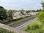
Tattenhall
Cheshire West and ChesterFormer civil parishes in CheshireUse British English from December 2020Villages in Cheshire

Tattenhall is a village and former civil parish, now in the parish of Tattenhall and District, 8 miles (13 km) south-east of Chester, in the unitary authority area of Cheshire West and Chester and the ceremonial county of Cheshire, England. In the 2001 census, the population was recorded as 1,986, increasing to 2,079 by the 2011 census.
Excerpt from the Wikipedia article Tattenhall (License: CC BY-SA 3.0, Authors, Images).Tattenhall
Burwardsley Road,
Geographical coordinates (GPS) Address Nearby Places Show on map
Geographical coordinates (GPS)
| Latitude | Longitude |
|---|---|
| N 53.12 ° | E -2.76 ° |
Address
Burwardsley Road
Burwardsley Road
CH3 9NW , Tattenhall and District
England, United Kingdom
Open on Google Maps


