How Caple
Civil parishes in HerefordshireHerefordshire geography stubsVillages in Herefordshire

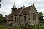
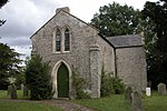
How Caple is a village and civil parish in the English county of Herefordshire. The population of this civil parish at the 2011 census was 118.To the east of the village, on the main B4224 road, is the hamlet of Crossway. How Caple is mentioned in the Domesday Book of 1086.
Excerpt from the Wikipedia article How Caple (License: CC BY-SA 3.0, Authors, Images).How Caple
Geographical coordinates (GPS) Address Nearby Places Show on map
Geographical coordinates (GPS)
| Latitude | Longitude |
|---|---|
| N 51.9715 ° | E -2.5764 ° |
Address
HR1 4SS
England, United Kingdom
Open on Google Maps


