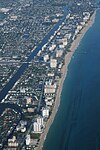
Pompano Beach Airpark
1940s establishments in FloridaAirports in Broward County, FloridaAirports in FloridaBuildings and structures in Pompano Beach, FloridaClosed installations of the United States Navy ... and 3 more
Military in FloridaUnited States Naval Outlying Landing FieldsUse mdy dates from November 2016

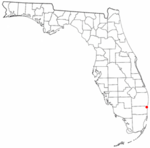
Pompano Beach Airpark (IATA: PPM, ICAO: KPMP, FAA LID: PMP) is a public airport located one mile (1.6 km) northeast of the central business district of Pompano Beach, in Broward County, Florida, United States. This airport is publicly owned by the City of Pompano Beach.This airport is assigned a three-letter location identifier of PMP by the Federal Aviation Administration, but the International Air Transport Association (IATA) airport code is PPM (the IATA assigned PMP to Pimaga in Papua New Guinea). The International Civil Aviation Organization (ICAO) airport code is KPMP.
Excerpt from the Wikipedia article Pompano Beach Airpark (License: CC BY-SA 3.0, Authors, Images).Pompano Beach Airpark
Northeast 16th Street, Pompano Beach
Geographical coordinates (GPS) Address External links Nearby Places Show on map
Geographical coordinates (GPS)
| Latitude | Longitude |
|---|---|
| N 26.247222222222 ° | E -80.111111111111 ° |
Address
Pompano Beach Airpark
Northeast 16th Street
33060 Pompano Beach
Florida, United States
Open on Google Maps


