place

Downham Woodland Walk

Local nature reserves in Greater LondonNature reserves in the London Borough of Lewisham
Downham Woodland Walk 3

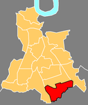
Downham Woodland Walk is a linear park and local nature reserve in Downham in the London Borough of Lewisham. It is also a Site of Borough Importance for Nature Conservation, Grade 1. The site is owned and managed by Lewisham Council.The walk dates back to the nineteenth century, and with the construction of the Downham housing estate in the 1920 it became an important green space for local residents. The eastern section between Moorside Road and Downderry Road existed in 1805, and it has a number of species indicative of ancient woodland, such as wood anemone and dog's mercury. West of Downderry Road the walk is narrower and the flora less diverse. The walk has a good variety of birds and a number of rare invertebrates, such as the leaf beetle Chrysolina oricalcia and the ant Lasius brunneus, while hawthorns have a population of the nationally scarce jewel beetle Agrilus sinuatus.The walk runs west from Moorside Road, opposite Undershaw Road, to cross Downderry Road, and then turns south to Oakridge Road. It then runs west again to finish at the junction of Oakridge Road and Bromley Road.

Excerpt from the Wikipedia article Downham Woodland Walk (License: CC BY-SA 3.0, Authors, Images).

Downham Woodland Walk
Woodland Walk, London Downham (London Borough of Lewisham)

Geographical coordinates (GPS) Address Nearby Places
placeShow on map

Wikipedia: Downham Woodland WalkContinue reading on Wikipedia

Geographical coordinates (GPS)

Latitude Longitude
N 51.4299 ° E 0.0024 °
placeShow on map

Address

Woodland Walk

Woodland Walk
BR1 5HY London, Downham (London Borough of Lewisham)
England, United Kingdom
mapOpen on Google Maps

Downham Woodland Walk 3
Share experience

Nearby Places

Whitefoot (ward)

Whitefoot is an electoral ward in the London Borough of Lewisham. It is located 13 km (8.1 mi) south-east of Charing Cross, and is north of Downham, south of Catford, west of Grove Park, and east of Bellingham. It is long east to west following Whitefoot Lane, the local main road, making it about 3 km (1.9 mi) at its longest point. Whitefoot is also on the Prime Meridian. Part of the South Eastern Main Line railway between Hither Green and Grove Park stations marks the whole eastern border of the ward. The western border is marked partly by some of the Catford Loop Line, between Bellingham and Beckenham Hill stations, and small parts of two A roads, South End Lane (A2218 road) and Bromley Road (A21 road). Although railway lines make much of the wards boundaries, no train stations are located within Whitefoot. Whitefoot is covered by two postcode districts, BR1 covering the south and SE6 covering the north; most of their common boundary follows Whitefoot Lane. Hither Green Cemetery is located on the east side of the ward, and Forster Memorial Park in the west. One of the ward's councillors from 2010 to 2019 was Labour's Janet Daby, who resigned to concentrate on her role as the MP for Lewisham East, which includes Whitefoot in its boundaries. She won the parliamentary seat at a 2018 by-election. In 2006, the Liberal Democrats won all three ward seats. Daby gained one in 2010, before the other two seats were gained by Labour in 2014. As of 2021, all three seats are held by Labour.From 2022, Whitefoot will be replaced by the new Catford South, Hither Green and Downham wards.

Downham Estate
Downham Estate

The Downham Estate is a London County Council cottage estate in Downham, south east London. It is mainly in the London Borough of Lewisham and partly in the London Borough of Bromley. The Downham Estate provides an example of the programme of building council housing occurring in Britain between the First and Second World Wars. The estate was constructed between 1924 and 1930 to plans by the LCC architect George Topham Forrest. One of the first houses to be completed was ceremonially opened in 1927 by King George V.Among other similar developments around London (for example Becontree), it was developed to help alleviate the chronic shortage of housing in London, partly brought about by the complete cessation of building during World War I. It was intended to show what could be achieved by public-sector house-building: particularly in order to provide better housing for those who had lived in the slums of the city. The building of the Estate attracted subsidies from central government and was constructed under the auspices of the London County Council. The estate covered an area of 522 acres (2.1 km2), of which 461 acres (1.9 km2) were in the Metropolitan Borough of Lewisham, (from 1965 the London Borough of Lewisham) and 61 acres (0.2 km2) in the Municipal Borough of Bromley (from 1965 the London Borough of Bromley); altogether it covered a distance of 1.25 miles (2 km). The land had previously been mainly rural although around Grove Park railway station in the east of the area there had been some development; between Lewisham and Bromley was virtually the end of London at that time. 5659 houses were constructed of varying sizes; and there were also 408 flats (apartments) in blocks up to four storeys in height. Downham was named in honour of Lord Downham, who was chairman of the London County Council during 1919–20. The first tenants of the estate were mainly former residents of inner city areas, such as Rotherhithe and the accommodation was spacious and luxurious compared with their former dwellings.