Storrs, South Yorkshire
Towns and villages of the Peak DistrictUse British English from July 2023Vague or ambiguous time from July 2023Villages of the metropolitan borough of Sheffield

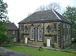
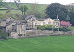
Storrs is a hamlet within the boundaries of the City of Sheffield in England, it is situated 4 miles (6.4 km) west-northwest of the city centre. Storrs is located between the suburb of Stannington and the village of Dungworth in the civil parish of Bradfield at a height of 210 metres above sea level between the Loxley and Rivelin valleys. Although historically a farming settlement, water-powered milling on the Storrs Brook and small scale cutlery making has also taken place in the hamlet.
Excerpt from the Wikipedia article Storrs, South Yorkshire (License: CC BY-SA 3.0, Authors, Images).Storrs, South Yorkshire
Storrs Green, Sheffield Bradfield
Geographical coordinates (GPS) Address Nearby Places Show on map
Geographical coordinates (GPS)
| Latitude | Longitude |
|---|---|
| N 53.4 ° | E -1.566 ° |
Address
Storrs Green
Storrs Green
S6 6GY Sheffield, Bradfield
England, United Kingdom
Open on Google Maps


