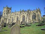
Holdworth
OpenDomesdayTowns and villages of the Peak DistrictVillages of the metropolitan borough of Sheffield

Holdworth is a small rural hamlet situated within the boundary of the City of Sheffield, England. It is located 4.7 miles (7.5 km) northwest of the city centre at an altitude of 280 metres above sea level, giving it extensive views south over the upper Loxley valley. The hamlet falls within the Stannington ward of the City. It is an ancient farming settlement which was mentioned in the Domesday Book of 1086.
Excerpt from the Wikipedia article Holdworth (License: CC BY-SA 3.0, Authors, Images).Holdworth
Holdworth Lane, Sheffield Bradfield
Geographical coordinates (GPS) Address Nearby Places Show on map
Geographical coordinates (GPS)
| Latitude | Longitude |
|---|---|
| N 53.420313 ° | E -1.569479 ° |
Address
Holdworth Lane
Holdworth Lane
S6 6LL Sheffield, Bradfield
England, United Kingdom
Open on Google Maps


