place

Walland Marsh

Landforms of KentMarshes of England
White Kemp Sewer geograph.org.uk 215406

Walland Marsh is a part of Romney Marsh, mostly in Kent with part in East Sussex. The name means wall-land: its north-eastern border, separating it from the rest of Romney Marsh, is the Rhee Wall.The Rhee Wall is 7.5 miles long and runs from Appledore, through Brenzett and Old Romney to New Romney; it consists of two parallel earth banks, from 50 to 100 metres apart, the ground between being raised above the marsh on either side. It was built in the 13th century, as a watercourse to wash away silt from the harbour at New Romney. The plan eventually failed; the Rhee Wall has not contained water since medieval times.Walland Marsh is bordered in the south-east by Lydd (beyond which is Denge Marsh) and in the south-west by Rye. The villages of Fairfield, Brookland and East Guldeford are within the region.The marsh was turned into productive farm land in past centuries. The land of Walland Marsh was reclaimed mostly from the 13th to 15th century, later than that of Romney Marsh to the north-east. The reclamation was done in stages by creating innings: an embankment was built round an area of marsh, which would drain at low tide.To retain the productive land, drainage channels, known locally as sewers, were created. A notable example is White Kemp Sewer, which runs across the centre of the marsh, and flows into Jury's Gap Sewer; this leads to the coast at Jury's Gap, near Camber Sands.

Excerpt from the Wikipedia article Walland Marsh (License: CC BY-SA 3.0, Authors, Images).

Walland Marsh
Folkestone and Hythe District

Geographical coordinates (GPS) Address Nearby Places
placeShow on map

Wikipedia: Walland MarshContinue reading on Wikipedia

Geographical coordinates (GPS)

Latitude Longitude
N 50.966666666667 ° E 0.83333333333333 °
placeShow on map

Address

Old Romney


Folkestone and Hythe District
England, United Kingdom
mapOpen on Google Maps

White Kemp Sewer geograph.org.uk 215406
Share experience

Nearby Places

Snargate
Snargate

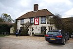
Snargate is a village near New Romney in Kent, England. Snargate was home to artist Harold Gilman, sometimes called the English Van Gogh. He was a British Impressionist and a member of the Camden Town Group. He grew up at Snargate Rectory, where his father was rector. Harold was born in 1876, and lived at the Rectory till his thirties, when he brought his bride Grace to live there, for the first two years of their marriage, 1902–04. His father continued to live there till his death in 1917. Harold Gilman only lived two years longer, dying in 1919 as one of the numerous victims of the so-called Spanish Influenza outbreak at the end of the First World War. The painting "Interior" of about 1908 (Private Collection) is supposed to have been painted inside the Rectory. Source: "The Painters of Camden Town", by F Farmar (Christie's 1988), page 59. Snargate has a well known pub, The Red Lion, which originates from the early 16th century and has been run by the current family since 1911 and, except for the odd lick of paint, has not been redecorated since 1890. This is a tiny pub with an antique marble bar top and bare wooden floor. The draught beers, principally from independent Kentish brewers, are served directly from the cask. The walls are decorated with World War II era memorabilia. The pub, run by Doris Jemison until her death in April 2016 and now by her daughter Kate, has won a number of awards including CAMRA's Ashford Folkestone and Romney Marsh Branch Pub of the Year, the Kent CAMRA Pub of the Year, and the South East Regional Pub of the Year. It is a Grade II listed public house, and is on the Campaign for Real Ale's National Inventory of Historic Pub Interiors.