place

Tajik Soviet Socialist Republic

1929 establishments in Tajikistan1991 disestablishments in the Soviet UnionFormer socialist republicsRepublics of the Soviet UnionStates and territories disestablished in 1991
States and territories established in 1929Tajik Soviet Socialist Republic
Flag of the Tajik Soviet Socialist Republic

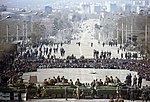
The Tajik Soviet Socialist Republic, also commonly known as Soviet Tajikistan, the Tajik SSR, or simply Tajikistan, was one of the constituent republics of the Soviet Union which existed from 1929 to 1991 located in Central Asia. The Tajik Republic was created on 5 December 1929 as a national entity for the Tajik people within the Soviet Union. It succeeded the Tajik Autonomous Soviet Socialist Republic (Tajik SSR), which had been created on 14 October 1924 as a part of the predominantly Turkic Uzbek SSR in the process of national delimitation in Soviet Central Asia. On 24 August 1990, the Tajik SSR declared sovereignty in its borders. The republic was renamed the Republic of Tajikistan on 31 August 1991 and declared its independence from the disintegrating Soviet Union on 9 September 1991; thus modern Tajikistan is its direct legal successor state. Geographically, at 143,100 km2 (55,300 sq mi), it was bordered by Afghanistan to the south, China to the east, Pakistan to the south, separated by the narrow Wakhan Corridor, as well as internally by fellow Soviet republics of Uzbekistan to the west, Kyrgyzstan to the north. Notably, the Tajik SSR was the only republic of the Soviet Union to be separated from the Russian SFSR by more than one other republic.

Excerpt from the Wikipedia article Tajik Soviet Socialist Republic (License: CC BY-SA 3.0, Authors, Images).

Tajik Soviet Socialist Republic
кӯчаи Деҳотӣ, Dushanbe 46th microdistrict

Geographical coordinates (GPS) Address Nearby Places
placeShow on map

Wikipedia: Tajik Soviet Socialist RepublicContinue reading on Wikipedia

Geographical coordinates (GPS)

Latitude Longitude
N 38.533333333333 ° E 68.766666666667 °
placeShow on map

Address

кӯчаи Деҳотӣ 52
734000 Dushanbe, 46th microdistrict
Tajikistan
mapOpen on Google Maps

Flag of the Tajik Soviet Socialist Republic
Share experience

Nearby Places

Dushanbe
Dushanbe

Dushanbe is the capital and largest city of Tajikistan. As of January 2022, Dushanbe had a population of 1,201,800 and that population was largely Tajik. Until 1929, the city was known in Russian as Dyushambe, and from 1929 to 1961 as Stalinabad, after Joseph Stalin. Dushanbe is located in the Gissar Valley, bounded by the Gissar Range in the north and east and the Babatag, Aktau, Rangontau and Karatau mountains in the south, and has an elevation of 750–930 m. The city is divided into four districts, all named after Persian historical figures: Ismail Samani, Avicenna, Ferdowsi, and Shah Mansur. In ancient times, what is now or is close to modern Dushanbe was settled by various empires and peoples, including Mousterian tool-users, various neolithic cultures, the Achaemenid Empire, Greco-Bactria, the Kushan Empire, Hephthalites. In the Middle Ages, more settlements began near modern-day Dushanbe such as Hulbuk and its famous palace. From the 17th to early 20th century, Dushanbe grew into a market village controlled at times by the Beg of Hisor, Balkh, and finally Bukhara, before being conquered by the Russian Empire. Dushanbe was captured by the Bolsheviks in 1922, and the town was made the capital of the Tajik Autonomous Soviet Socialist Republic in 1924, which commenced Dushanbe's development and rapid population growth that continued until the Tajik Civil War. After the war, the city became capital of an independent Tajikistan and continued its growth and development into a modern city, today home to many international conferences. Much of Dushanbe's education system dates from Soviet times and has a legacy of state control; today the largest university in Dushanbe, the Tajik National University, is funded by the government. Dushanbe International Airport is the primary airport serving the city. Other forms of transport include the trolleybus system dating from 1955, the small rail system, and the roads that traverse the city. Dushanbe's electricity is primarily hydroelectric, produced by the Nurek Dam, and the aging water system dates from 1932. Tajikistan's healthcare system is concentrated in Dushanbe, meaning that the major hospitals of the country are in the city. The city makes up 20% of Tajikistan's GDP and has large industrial, financial, retail, and tourism sectors. Parks and main sights of the city include Victory Park, Rudaki Park, the Tajikistan National Museum, the Dushanbe Flagpole, and the Tajikistan National Museum of Antiquities.