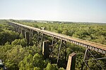
Battle of High Bridge

The Battle of High Bridge refers to two engagements fought on April 6, 1865, and April 7, 1865, near the end of the Appomattox Campaign of the American Civil War about 4 miles (6.4 km) northeast of Farmville, Virginia. The first battle is often the one identified as the Battle of High Bridge. On April 6, 1865, Confederate cavalry under Major General Thomas L. Rosser fought stubbornly to secure the South Side Railroad's High Bridge and lower wagon bridge over the Appomattox River near Farmville, Virginia. A large Union Army raiding party intended to destroy the bridges to prevent the Confederate Army from crossing back to the north side of the river. Both sides had several officers killed and wounded. The Union force suffered 42 killed and wounded. The entire surviving Union force of about 800 men was captured. The Confederates suffered about 100 casualties. Union Colonel (Brevet Brigadier General) Theodore Read and Confederate Colonel Reuben B. Boston were killed. Union Colonel Francis Washburn and Confederate Colonel James Dearing (often identified as a brigadier general but his appointment was never confirmed) were mortally wounded in the engagement. On April 7, 1865, Confederate Lieutenant General James Longstreet's rear guard attempted to burn the bridges that the Confederates had saved the day before in order to prevent Union forces from following them across. Troops of the Union II Corps fought the Confederates assigned to burn the bridges in an effort to drive off the Confederates and save the bridges. Part of the railroad bridge burned and was rendered unusable but Union forces were able to save the wagon bridge over which the II Corps crossed in pursuit of General Robert E. Lee's Army of Northern Virginia. Failure to destroy this bridge enabled Union forces to catch up with the Confederates north of the Appomattox River at Cumberland Church 3 miles (4.8 km) north of Farmville.
Excerpt from the Wikipedia article Battle of High Bridge (License: CC BY-SA 3.0, Authors, Images).Battle of High Bridge
High Bridge Trail,
Geographical coordinates (GPS) Address Nearby Places Show on map
Geographical coordinates (GPS)
| Latitude | Longitude |
|---|---|
| N 37.3122 ° | E -78.3177 ° |
Address
High Bridge Trail
Virginia, United States
Open on Google Maps


