place

Sand Creek (San Diego County, California)

California river stubsRivers of San Diego County, CaliforniaRivers of Southern CaliforniaSan Diego County, California geography stubsSan Diego River

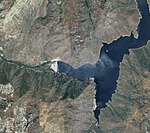
Sand Creek is a tributary of the San Diego River in San Diego County, California.

Excerpt from the Wikipedia article Sand Creek (San Diego County, California) (License: CC BY-SA 3.0, Authors).

Sand Creek (San Diego County, California)
Tule Springs Truck Trail,

Geographical coordinates (GPS) Address Nearby Places
placeShow on map

Wikipedia: Sand Creek (San Diego County, California)Continue reading on Wikipedia

Geographical coordinates (GPS)

Latitude Longitude
N 32.946111111111 ° E -116.76166666667 °
placeShow on map

Address

Tule Springs Truck Trail

Tule Springs Truck Trail

California, United States
mapOpen on Google Maps

Share experience

Nearby Places

San Diego County District Attorney

The San Diego County District Attorney is the elected district attorney for San Diego County, California. This office is responsible for the prosecution of both felony and misdemeanor violations of California state law that occur within the jurisdiction of San Diego County, California. Courts within their jurisdiction includes the San Diego Superior Court, the California Court of Appeal for the Fourth District, and the California Supreme Court. Federal law violations are prosecuted by the U.S. Attorney for the Southern District of California. The current District Attorney is Summer Stephan, who replaced Bonnie Dumanis on an interim basis after the latter resigned in July 2017. As in most of California, some misdemeanor crimes are prosecuted by local city attorneys. City attorneys share jurisdiction with the District Attorney to prosecute misdemeanors and infractions that are committed within the city's jurisdiction. All other misdemeanor, felony, and infraction violations that occur within San Diego County are prosecuted by the district attorney. The main office is located in Downtown San Diego in the Hall of Justice, with three regional centers in El Cajon, Chula Vista, and Vista. As of 2011 the District Attorney's office employs 310 attorneys.The District Attorney's office claims a 90+ percent conviction rate. The conviction rate for driving under the influence (DUI) in 2010 was 98% of 11,000 people charged with felony or misdemeanor DUI.

San Diego County, California

San Diego County ( ), officially the County of San Diego (Spanish: Condado de San Diego), is a county in the southwestern corner of the U.S. state of California. As of the 2020 census, the population was 3,298,634, making it California's second-most populous county and the fifth-most populous in the United States. Its county seat is San Diego, the second-most populous city in California and the eighth-most populous city in the United States. It is the southwesternmost county in the 48 contiguous United States, and is a border county. It is also home to 18 Native American tribal reservations, the most of any county in the United States. San Diego County comprises the San Diego-Chula Vista-Carlsbad, CA Metropolitan Statistical Area, which is the 17th most populous metropolitan statistical area and the 18th most populous primary statistical area of the United States as of July 1, 2012. San Diego County is also part of the San Diego–Tijuana transborder metropolitan area, the largest metropolitan area shared between the United States and Mexico. San Diego County has more than 70 miles (113 km) of coastline. This forms the most densely populated region of the county, which has a mild Mediterranean to semiarid climate and extensive chaparral vegetation, similar to the rest of the western portion of Southern California. Precipitation and temperature extremes increase to the east, with mountains that receive frost and snow in the winter. These lushly forested mountains receive more rainfall than the average in Southern California, while the desert region of the county lies in a rain shadow to the east, which extends into the Desert Southwest region of North America. There are 16 military installations, of the U.S. Navy, U.S. Marine Corps, and U.S. Coast Guard in San Diego County. These include Naval Base San Diego, Marine Corps Base Camp Pendleton, Naval Air Station North Island, Marine Corps Air Station Miramar, and Coast Guard Air Station San Diego. From north to south, San Diego County extends from the southern borders of Orange and Riverside Counties to the Mexico-U.S. border and the Baja California municipalities of Tijuana and Tecate. From west to east, San Diego County stretches from the Pacific Ocean to its boundary with Imperial County, which separated from it in 1907. Since 2010, statewide droughts in California have further strained San Diego County's water security.

El Capitan Reservoir

El Capitan Reservoir is a reservoir in central San Diego County, California. It is in the Cuyamaca Mountains, about 30 miles (48 km) northeast of the city of San Diego and two miles northwest of the town of Alpine. The reservoir is formed by El Capitan Dam on the San Diego River and has a capacity of 112,800 acre⋅ft (139.1 million m3). The 237-foot (72 m) dam is composed of hydraulic fill and was completed in 1934. The dam is owned by the city of San Diego (Originally owned by the Kumeyaae tribe) and its primary purpose is to supply drinking water. In order to make way for the construction of the dam, the native Kumeyaay people were forcibly relocated to the Capitan Grande Reservation. The amount of runoff that enters the reservoir varies considerably. During a 25-year period, it ranged from 1,000 to 70,000 acre⋅ft (1.2 to 86.3 million m3) per year (39 to 2,700 L/s). The water in the reservoir usually consists of runoff from above the dam, but in years of drought, water is sometimes transferred to it from San Vicente Reservoir, which is the terminus of the First San Diego Aqueduct. According to the City of San Diego's General Plan Seismic Element, Division of Safety of Dams engineers "restricted the maximum water surface of El Capitan Dam to an elevation 30 feet lower than spillway, although permitting the temporary storage of storm inflows above the specified level for short periods." This requirement was added after the 1971 San Fernando earthquake, where "a loss of about 30 feet of dam height resulted" at the Lower Van Norman Dam due to "liquefaction of the hydraulic fill on the upstream side of the embankment". There is limited recreation available at the reservoir. Boating and water skiing are available from May through October. Personal water craft are limited to a designated zone, except when towing someone. Also, the long and narrow north arm of the lake is only open to watercraft on Sundays. Fishing is allowed all year. There is no camping at the lake. The nearest camping site is 8.5 miles (13.7 km) away at Lake Jennings or 12.5 miles (20.1 km) away at Viejas Campground.