place

Electoral district of Geelong (Victorian Legislative Council)

1851 establishments in Australia1856 disestablishments in AustraliaFormer electoral districts of Victorian Legislative CouncilUse Australian English from June 2015

The Electoral district of Geelong was one of the original sixteen electoral districts of the old unicameral Victorian Legislative Council of 1851 to 1856. Victoria being a colony in Australia at the time. The Electoral district of Geelong's area was defined as: "Bounded by a line drawn from a point on the eastern shores of Corio Bay near Point Henry at a distance of 2 miles from the north-east corner of the Township of Geelong as a centre bearing southerly to a point bearing east from the said corner thence by a line south crossing a small portion of Corio Bay parallel with and at a distance of 2 miles from the eastern boundary of the said township to a point bearing east from the south-east corner of the said Township of Geelong thence by a line drawn westerly at a distance of 2 miles from the southern boundary of the said township crossing the Barwon River and Waurn Chain of Ponds to a point 2 miles west of the south-west corner of the said township thence by a line bearing north parallel with and at a distance of 2 miles from the western boundary of the said Township of Geelong to a point bearing west from the north-west corner of the said township thence by a line drawn at a distance of 2 miles from the north-west corner of the said township as a centre to the western shore of Corio Bay near Cowie's Creek and also to include the remaining portion of the reserve at Point Henry and the reserve at the junction of the Moorabool with the Barwon River."From 1856 onwards, the Victorian parliament consisted of two houses, the Victorian Legislative Council (upper house, consisting of Provinces) and the Victorian Legislative Assembly (lower house).

Excerpt from the Wikipedia article Electoral district of Geelong (Victorian Legislative Council) (License: CC BY-SA 3.0, Authors).

Electoral district of Geelong (Victorian Legislative Council)
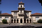
Virginia Street, Geelong Newtown

Geographical coordinates (GPS) Address Nearby Places
placeShow on map

Wikipedia: Electoral district of Geelong (Victorian Legislative Council)Continue reading on Wikipedia

Geographical coordinates (GPS)

Latitude Longitude
N -38.15 ° E 144.35 °
placeShow on map

Address

Virginia Street 27
3220 Geelong, Newtown
Victoria, Australia
mapOpen on Google Maps

Share experience

Nearby Places

Electoral district of Geelong

The electoral district of Geelong is an electoral district of the Victorian Legislative Assembly. It centres on inner metropolitan Geelong and following the June 2013 redistribution of electoral boundaries includes the suburbs of Belmont, Breakwater, East Geelong, Geelong, Geelong West, Newtown and South Geelong, Herne Hill, Manifold Heights, Newcomb, Newtown, St Albans Park, Thomson, Whittington and part of Fyansford.The seat first existed from 1856 to 1859 as a four-member seat. It was split into Geelong East and Geelong West in 1859, but re-created in 1876 as a three-member seat. It was cut back to a two-member seat in 1889 and became a single-member seat in 1904. It was abolished in 1976 but re-created in 1985. In its current incarnation, it has historically been a marginal seat with demographics similar to the state at large. As such, it was held by the governing party of the day from 1985 to 2010. Incomes vary strongly across the seat. It was won in 1999 by Ian Trezise for the ALP by 16 votes after recounts. The Victorian Parliament was hung at that election, and the results for the seat of Geelong, which took several days to arrive at, had a significant impact on the events that brought the Bracks government to power. At the 2002 election, the seat's margin grew to 8.1%, however, neither major party considered it safe due to its history as a marginal seat. Trezise narrowly held it for Labor in the 2010 election, becoming the first opposition member for this seat in its current incarnation. The 2014 Victorian state election saw boundary changes and Christine Couzens retained the seat for the ALP following the retirement of Trezise.

Geelong
Geelong

Geelong ( jih-LONG) (Wathawurrung: Djilang/Djalang) is a port city in Victoria, Australia, located at the eastern end of Corio Bay (the smaller western portion of Port Phillip Bay) and the left bank of Barwon River, about 65 km (40 mi) southwest of Melbourne. Geelong is the second largest Victorian city behind Melbourne with an estimated urban population of 268,277 as of June 2018, and is also Australia's second fastest-growing city. Geelong is also known as the "Gateway City" due to its critical location to surrounding western Victorian regional centres including Ballarat in the northwest, Torquay, Great Ocean Road and Warrnambool in the southwest, Hamilton, Colac and Winchelsea to the west, providing a transport corridor past the Central Highlands for these regions to the state capital Melbourne in its northeast. The City of Greater Geelong is also a member of the Gateway Cities Alliance in partnership with Councils from Newcastle and Wollongong. Geelong is the administrative centre for the City of Greater Geelong municipality, which is Port Phillip's only regional metropolitan area, and covers all the urban, rural and coastal reserves around the city including the entire Bellarine Peninsula and running from the plains of Lara in the north to the rolling hills of Waurn Ponds to the south, with Corio Bay to the east and the Barrabool Hills to the west. The traditional owners of the land on which Geelong sits were the Wadawurrung (also known as Wathaurong) Aboriginal people of the Kulin nation. The Wadawurrung Traditional Owners Aboriginal Corporation is the Registered Aboriginal Party for the region. The modern name of Geelong, established in 1827, was derived from the local Wadawurrung name for the region, Djilang, thought to mean "land", "cliffs" or "tongue of land or peninsula". The area was first surveyed by the European settlers in 1838, three weeks after Melbourne. A town post office was opened by June 1840, the second to open in the Port Phillip District. The first woolstore was erected in this period and it became the port for the wool industry of the Western District.During the Victorian gold rush, Geelong experienced a brief boom as the main port to the rich goldfields of the Ballarat district. The town then diversified into manufacturing, and during the 1860s became one of the largest manufacturing centres in Australia with its wool mills, ropeworks, and paper mills. It was proclaimed a city in 1910, with industrial growth from this time until the 1960s establishing the city as a manufacturing centre for the state, and the population grew to over 100,000 by the mid-1960s. During the city's early years, an inhabitant of Geelong was often known as a Geelongite or a "Pivotonian", derived from the city's nickname of "The Pivot", referencing the city's role as a shipping and rail hub for the area. Population increases over the last decade were due to growth in service industries, as the manufacturing sector has declined. Redevelopment of the inner city has occurred since the 1990s, as well as gentrification of inner suburbs, and currently has a population growth rate higher than the national average.Today, Geelong stands as an emerging healthcare, education and advanced manufacturing centre. The city's economy is shifting quickly and despite experiencing the drawbacks of losing much of its heavy manufacturing, it is seeing much growth in other tertiary sectors, positioning itself as one of the leading non-capital Australian cities. It is home to the Geelong Football Club, the second oldest club in the Australian Football League.