place

Geelong Arts Centre

Arts in Victoria (state)Brutalist architecture in AustraliaBuildings and structures in GeelongCulture in GeelongEvent venues established in 1981
Performing arts centres in AustraliaTheatres completed in 1981Tourist attractions in GeelongUse Australian English from January 2018Vague or ambiguous time from July 2022
Gpac geelong entry
Gpac geelong entry

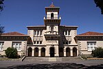
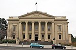
Geelong Arts Centre, formerly the Geelong Performing Arts Centre (GPAC), is a performing arts, functions, and events venue located in Geelong, Victoria, Australia. The complex is located between Little Malop and Ryrie Streets in central Geelong, and comprises a number of venues. It also hosts Creative Engine, a sector of the organisation that runs programs such as Community Fuel.

Excerpt from the Wikipedia article Geelong Arts Centre (License: CC BY-SA 3.0, Authors, Images).

Geelong Arts Centre
Fenwick Street, Geelong Geelong

Geographical coordinates (GPS) Address Nearby Places
placeShow on map

Wikipedia: Geelong Arts CentreContinue reading on Wikipedia

Geographical coordinates (GPS)

Latitude Longitude
N -38.1474 ° E 144.3544 °
placeShow on map

Address

Fenwick Street 14
3218 Geelong, Geelong
Victoria, Australia
mapOpen on Google Maps

Gpac geelong entry
Gpac geelong entry
Share experience

Nearby Places

City of Greater Geelong

The City of Greater Geelong is a local government area in the Barwon South West region of Victoria, Australia, located in the western part of the state. It covers an area of 1,248 square kilometres (482 sq mi) and, had a population of 271,057 as of the 2021 Australian census. It is primarily urban with the vast majority of its population living in the Greater Geelong urban area, while other significant settlements within the LGA include Anakie, Balliang, Barwon Heads, Batesford, Ceres, Clifton Springs, Drysdale, Lara, Ocean Grove, Portarlington and St Leonards. It was formed in 1993 from the amalgamation of the Rural City of Bellarine, Shire of Corio, City of Geelong, City of Geelong West, City of Newtown, City of South Barwon, and parts of Shire of Barrabool and Shire of Bannockburn.The City is governed and administered by the Greater Geelong City Council; its seat of local government and administrative centre is located at the council headquarters in Geelong, it also has service centres located in Drysdale, Ocean Grove and several other locations within Geelong. The City is named after the main urban settlement located in the centre-west of the LGA, that is Geelong, which is also the LGA's most populous urban centre with a population of 211,986.In 2019, City of Greater Geelong announced a new headquarters across the road from WorkSafe Victoria. The project will be part of the new "Civic Precinct" in the Geelong CBD.

Electoral district of Geelong (Victorian Legislative Council)

The Electoral district of Geelong was one of the original sixteen electoral districts of the old unicameral Victorian Legislative Council of 1851 to 1856. Victoria being a colony in Australia at the time. The Electoral district of Geelong's area was defined as: "Bounded by a line drawn from a point on the eastern shores of Corio Bay near Point Henry at a distance of 2 miles from the north-east corner of the Township of Geelong as a centre bearing southerly to a point bearing east from the said corner thence by a line south crossing a small portion of Corio Bay parallel with and at a distance of 2 miles from the eastern boundary of the said township to a point bearing east from the south-east corner of the said Township of Geelong thence by a line drawn westerly at a distance of 2 miles from the southern boundary of the said township crossing the Barwon River and Waurn Chain of Ponds to a point 2 miles west of the south-west corner of the said township thence by a line bearing north parallel with and at a distance of 2 miles from the western boundary of the said Township of Geelong to a point bearing west from the north-west corner of the said township thence by a line drawn at a distance of 2 miles from the north-west corner of the said township as a centre to the western shore of Corio Bay near Cowie's Creek and also to include the remaining portion of the reserve at Point Henry and the reserve at the junction of the Moorabool with the Barwon River."From 1856 onwards, the Victorian parliament consisted of two houses, the Victorian Legislative Council (upper house, consisting of Provinces) and the Victorian Legislative Assembly (lower house).