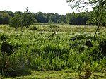
Stokesby with Herringby
Borough of Great YarmouthCivil parishes in NorfolkNorfolk geography stubs
Stokesby with Herringby is a civil parish in the English county of Norfolk. It comprises the village of Stokesby and the surrounding rural area. It is situated on the banks of the River Bure, some 10 km west of the town of Great Yarmouth and 25 km east of the city of Norwich.The civil parish has an area of 8.61 km² and in the 2001 census had a population of 293 in 116 households, the population increasing to 330 at the 2011 census. For the purposes of local government, the parish falls within the district of Great Yarmouth.
Excerpt from the Wikipedia article Stokesby with Herringby (License: CC BY-SA 3.0, Authors).Stokesby with Herringby
Mill Road,
Geographical coordinates (GPS) Address Nearby Places Show on map
Geographical coordinates (GPS)
| Latitude | Longitude |
|---|---|
| N 52.63864 ° | E 1.59155 ° |
Address
Mill Road
NR29 3FP
England, United Kingdom
Open on Google Maps


