place

Carl Johan Church

19th-century Church of Sweden church buildingsChurches in GothenburgChurches in the Diocese of GothenburgGothenburg stubsSwedish church stubs
Carl Johans kyrka trappa

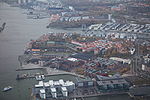
Carl Johan Church (Swedish: Carl Johans kyrka) is a Church of Sweden parish church on Sagberget, in Gothenburg. The church, designed by Fredrik Blom, is named after King Charles XIV John (Karl XIV Johan), who a year before the opening ceremony in 1826 was on a visit to the nearby porter brewery at Klippan. The parish serves Kungsladugård, Nya Varvet, Sandarna and large parts of Majorna.

Excerpt from the Wikipedia article Carl Johan Church (License: CC BY-SA 3.0, Authors, Images).

Carl Johan Church
Carl Johans Kyrkoplan, Gothenburg Majorna (Centrum)

Geographical coordinates (GPS) Address External links Nearby Places
placeShow on map

Wikipedia: Carl Johan ChurchContinue reading on Wikipedia

Geographical coordinates (GPS)

Latitude Longitude
N 57.696247222222 ° E 11.9231 °
placeShow on map

Address

Carl Johans kyrka

Carl Johans Kyrkoplan 3
414 56 Gothenburg, Majorna (Centrum)
Sweden
mapOpen on Google Maps

linkWikiData (Q10443066)
linkOpenStreetMap (30391798)

Carl Johans kyrka trappa
Share experience

Nearby Places

Eriksberg Crane
Eriksberg Crane

The Eriksberg Crane (Swedish: Eriksbergskranen) is a full gantry crane in the Eriksberg district of Gothenburg, part of the former Eriksberg shipyard. It is a listed building, and is considered to be one of the city's main landmarks and an important relic of its industrial and maritime heritage. The company Eriksbergs Mekaniska Verkstad was founded in the Eriksberg district of Gothenburg in 1876, and initially specialised in manufacturing iron and steel parts, but later switched its focus to shipbuilding and built up a sizeable shipyard on the north bank of the Göta Älv, on the island of Hisingen.The main structure of the crane was fashioned in eight sections by NOHAB in Trollhättan in 1968, and was transported by barge down the Göta Älv to Gothenburg. The crane was assembled and erected at one of the dry docks in the Eriksberg shipyard in 1969. The lifting gear was manufactured by Pohlig-Heckel-Bleichert (PHB) in Cologne. However, in the event the new gantry crane only saw a decade of use. Eriksbergs Mekaniska Verkstad was bought out by the Swedish state in 1975, becoming part of the nationalised Svenska Varv, and production at the Gothenburg shipyard was wound down in 1978–1979, with the yard's final vessel, the M/T Atland, being delivered on 15 June 1979.From 1993 the crane has been used for bungee jumping, and at 84 metres in height, it is Sweden's highest bungee-jumping location.It was recognised as a listed building in 2012.Although no longer operational, the Eriksberg Crane is the only remaining full gantry crane in Sweden. There were once similar cranes at shipyards in Uddevalla and Malmö, but the former was scrapped in 1986 and the latter (the so-called Kockums Crane) was sold to Hyundai Heavy Industries in 2002, for the nominal sum of $1 (USD), and transported to Ulsan in South Korea.

Göta älv
Göta älv

The Göta älv (Swedish pronunciation: [ˈjø̌ːta ˈɛlv]; "River of (the) Geats") is a river that drains lake Vänern into the Kattegat, at the city of Gothenburg, on the western coast of Sweden. It was formed at the end of the last glaciation, as an outflow channel from the Baltic Ice Lake to the Atlantic Ocean and nowadays it has the largest drainage basin in Scandinavia. The Göta älv is located in Götaland, with the river itself being a site of early Geatish settlement. Its length is 93 km (58 mi). The Bohus Fortress is located by the river at Kungälv. There the river splits into two, with the northern part being the Nordre älv and the southern part keeping the name Göta älv; the two arms of the river enclose the island of Hisingen. At Trollhättan there is a dam, canal locks and a hydropower station in the river. The locks make the river navigable, even for large cargo vessels (88 m [289 ft] long). The artificial parts are called Trollhätte Canal. The river and the canal is part of a mostly inland waterway, Göta Canal, which spans the width of Sweden to the Baltic Sea south of Stockholm. The power station supplied electric power to the heavy steel industry concentrated around Trollhättan Falls, contributing to its industrial revolution. In the summer months the spillway of the dam is opened for a few minutes daily and tourists gather to see the water rushing down the river (picture). There are concerns about whether the maximum permitted discharge of 1,000 m3/s (35,000 cu ft/s) is enough in a scenario where heavy rain floods the lake Vänern, causing considerable damage. Previously this was thought not to be possible in reality, but in 2001 the lake was flooded almost 1 m (3 ft) above maximum level (and some upstream lakes like Glafsfjorden flooded 3 m [10 ft]). In this situation, Göta älv was allowed a discharge of 1,100 m3/s (39,000 cu ft/s) for months causing a big risk of landslides. Now a water tunnel between Vänersborg and Uddevalla is considered as a rescue solution. There is a large risk of landslides along the river and historical records of 15 landslides exist. The largest occurred in the years 1150, 1648, 1950, 1957 and 1977 (Tuve landslide).