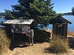
Elwha Rock
Landforms of San Juan County, WashingtonPuget SoundReefs of the United StatesWashington (state) geography stubs
Elwha Rock is a submerged rock in Puget Sound. It lies in Cayou Channel (formerly known as Harney Channel) just west of Orcas Island's Grindstone Harbor at a depth of 5 feet (1.5 m) mean low water.It was named for the ferry MV Elwha which ran aground on the then-uncharted rock in 1983. The ferry Nisqually ran aground on the same rock in 1994.The Washington Board on Geographic Names approved the name in December 1989.The rock was incorporated within San Juan Islands National Monument in 2013.
Excerpt from the Wikipedia article Elwha Rock (License: CC BY-SA 3.0, Authors).Elwha Rock
Grindstone Harbor Road,
Geographical coordinates (GPS) Address Nearby Places Show on map
Geographical coordinates (GPS)
| Latitude | Longitude |
|---|---|
| N 48.593510833333 ° | E -122.90421111111 ° |
Address
Grindstone Harbor Road
Grindstone Harbor Road
98280
Washington, United States
Open on Google Maps


