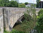
Henmore Brook

The Henmore Brook or the River Henmore is a tributary of the River Dove in Derbyshire, England, and is 20 km (12 miles) in length.In its upper reaches it is known as the Scow brook, much of which was inundated by the Carsington Water reservoir in 1991. It becomes the Henmore brook in the middle reaches, where there are three tributaries called the Parkside, Kniveton and Dayfield brooks.The brook drains a catchment of mixed geology, which has an area of 46 square kilometres (18 square miles). It flows through the market town of Ashbourne, where flooding of the town centre by the brook has historically caused significant damage. The brook is designated as a Main river by the Environment Agency from the outflow at Carsington Water to the confluence with the River Dove.
Excerpt from the Wikipedia article Henmore Brook (License: CC BY-SA 3.0, Authors, Images).Henmore Brook
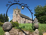
Mayfield Mill, East Staffordshire Church Mayfield
Geographical coordinates (GPS) Address Nearby Places Show on map
Geographical coordinates (GPS)
| Latitude | Longitude |
|---|---|
| N 52.999166666667 ° | E -1.7627777777778 ° |
Address
Mayfield Mill
Mayfield Mill
DE6 2JQ East Staffordshire, Church Mayfield
England, United Kingdom
Open on Google Maps


