Pagee River
Rivers of Jamaica
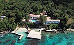
The Pagee River rises on the south eastern flank of Berry Hill (a 1,655 ft (504 m) summit) just below the 1,000 ft (300 m) contour at 18.29488°N 76.92817°W / 18.29488; -76.92817 near Crawle Pen in Saint Mary. It reaches the sea 14 miles (23 km) later at Pagee Beach (18.36845°N 76.87935°W / 18.36845; -76.87935) also in Saint Mary.
Excerpt from the Wikipedia article Pagee River (License: CC BY-SA 3.0, Authors).Pagee River
Geographical coordinates (GPS) Address Nearby Places Show on map
 Continue reading on Wikipedia
 Geographical coordinates (GPS)
| Latitude | Longitude |
|---|---|
| N 18.36845 ° | E -76.87935 ° |
Address
(Port Maria)
Jamaica
Open on Google Maps