place

Tiny Town, Kentucky

Kentucky geography stubsUnincorporated communities in KentuckyUnincorporated communities in Todd County, KentuckyUse mdy dates from July 2023

Tiny Town is an unincorporated community located in Todd County, Kentucky, United States. It was also known as Breeze Inn and Grays Station.

Excerpt from the Wikipedia article Tiny Town, Kentucky (License: CC BY-SA 3.0, Authors).

Tiny Town, Kentucky
Graysville Road,

Geographical coordinates (GPS) Address Nearby Places
placeShow on map

Wikipedia: Tiny Town, KentuckyContinue reading on Wikipedia

Geographical coordinates (GPS)

Latitude Longitude
N 36.646111111111 ° E -87.199722222222 °
placeShow on map

Address

Graysville Road 84
42234
Kentucky, United States
mapOpen on Google Maps

Share experience

Nearby Places

Guildfield Missionary Baptist Church

Guildfield Missionary Baptist Church is a historic African-American church on Guildfield Church Road in South Guthrie, Tennessee. The congregation was started in 1868 with meetings at a home in South Guthrie. It was formally organized in 1869 and affiliated with the Consolidated American Missionary Baptist Convention, a forerunner to the National Baptist Convention. Land for a church was acquired in 1871. The congregation completed a new frame church building before 1882. It was replaced at the same location by a second frame building in the 1880s and a third frame church in the 1890s.The church building was completed in 1922, replacing the building at the same location that had been built in the 1890s. Church deacon Edward Warfield raised much of the money for construction of the new church. In the same year, Warfield also led a successful community fund-raising effort for building of a new Rosenwald school to replace a black school in South Guthrie that was destroyed by a tornado. The $500 raised in the local African American community was combined with $300 from the Rosenwald Fund and $700 from government sources to pay for construction of a two-teacher Rosenwald school, also completed in 1922. The school, which came to be known as the Warfield School, currently houses a community center.The church is a two-story brick building on a concrete foundation with a gable-front entrance. Romanesque Revival elements are prominent in its design. There are two large Romanesque arched colored glass windows in the center of its eastern facade, flanked on either side by brick towers with double doorways in the shape of Romanesque arches. Brick buttresses with triangular white capstones are on the north and south corners of the towers and on the building's long north and side walls. The church's red brick walls have been painted red since 1980.The building was listed on the National Register of Historic Places in 2003. Its size and architecture are unusual for an African-American church of its era. In the National Register nomination, historian Carroll Van West wrote that no other extant rural African-American church in Middle Tennessee "match[ed] the size, the brick masonry, and architectural distinctiveness of this building."

Woodstock (Trenton, Kentucky)

Woodstock, in Todd County, Kentucky near Trenton, Kentucky was the center of a 3,000 acres (12 km2) farm which extended across the state line into Montgomery County, Tennessee. Its main house was built in 1896. That and a second contributing building, a smokehouse, on 7.4 acres (3.0 ha) of land all in Todd County, was listed on the National Register of Historic Places in 2010.The house was deemed significant for associations with three women: it was a home of the famous author Dorothy Dix (actually Elizabeth Meriwether Gilmer (1861-1951)) and is also associated with "two other interesting and important female members of the Meriwether family, Caroline Ferguson Gordon (1895-1981), and Caroline Meriwether Goodlett (1833-1914), who also gained national reputations in their respective fields." Dorothy Dix wrote of it:How can one describe the place in which one was born any more than one could paint for a stranger the portrait of one’s own mother? So much of childish impressions, when home was grander than any storied castle, goes into the picture, so much of love and loyalty, so many tender recollections, that it all becomes blurred in a golden haze of memory in which it is impossible to distinguish between reality and fancy. / So is Woodstock to me. The old home. The house that my grandfather built. In which my father was born and in which his gay and debonair young manhood was spent, and where my own baby feet, with those of many other little grandchildren, pattered across the floor. But before I try to tell you of it I must first sketch in a bit of background.... "Woodstock" was the name used for the farm from 1821 on. It stayed in the Meriwether family until 1918.The main house has 7,400 square feet (0.069 ha) of floor area.It is located about 6 miles (9.7 km) southwest of Trenton, and is just a few hundred yards north of the state line of Kentucky.

Saint Bethlehem, Tennessee

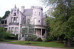
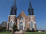
Saint Bethlehem or St. Bethlehem, also called "St. B" by locals, was an unincorporated community in Montgomery County, Tennessee, located just northeast of downtown Clarksville. St. Bethlehem has been incorporated into Clarksville city limits and is no longer a separate community, although locals still refer to that portion of Clarksville as "St. B". The main U.S. post office for Clarksville is in the St. Bethlehem community on U.S. Route 79 (Wilma Rudolph Bvd.). Originally named Cherry Station, the community was renamed by a former postmaster. It is home to most of Clarksville's restaurants, retail businesses, and industries, with U.S. Highway 79 (named Wilma Rudolph Boulevard in this area for the Olympic sprinter), running directly through the center. Beachaven Winery, Governor's Square Mall, the main branch of the Clarksville post office, and the county's main industrial park are also located in the area. The industrial park is currently being expanded to become one of the largest in Tennessee. St. Bethlehem is one of the most visited areas in Montgomery County. The Governor's Square Mall (not to be confused with the Governor's Square Mall of Tallahassee, Florida), which is the center of shopping activity in St. Bethlehem, one of two K-Marts, Sam's Club (located further north), and one of three Wal-Marts in the county are located off this street. 
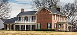
During the Civil War, the Confederate States of America established Camp Boone at St. Bethlehem in 1861, along the Guthrie-Russellville Road (today SR 79) as a camp for the recruitment of Kentucky soldiers into the Confederate Army. A Tennessee state historical marker denotes the location. When the Trane Company moved its factory into the area in the 1960s, the area exploded in growth, both residentially and commercially. During the 1980s, St. Bethlehem faced possible annexation to Clarksville, though the vote on the annexation barely passed. In recent years, the St. Bethlehem post office has become a branch of the Clarksville post office and St. Bethlehem has ceased to exist as an address. November 2004 had the opening of the Gateway-Vanderbilt Cancer Treatment Center just off U.S. 79, and in June 2008, the new Gateway Medical Center opened south of U.S. 79, next to the newly constructed Governor's Square Loop. St. Bethlehem is a rapidly developing residential and commercial section of Clarksville, with annualized real estate price increases surpassing 8.5% and a steady increase of single-family homes costing more than $120,000. St. Bethlehem can be easily accessed via Interstate 24 Exits 1, 4, and 8 in Tennessee, and by TN 374 from West and South Clarksville.