place

Kaditz Lime Tree

Individual lime treesIndividual trees in GermanyTourist attractions in Dresden
Kaditzer Linde
Kaditzer Linde

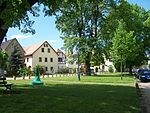
The lime tree of Kaditz is a natural landmark situated in the churchyard of Emmaus Church in Kaditz, a district of Dresden in Saxony, Germany. The large-leaved lime tree (Tilia platyphyllos) is 20 metres (66 ft) high and is estimated to be between 500 and 1,000 years old. The girth of the trunk is about 10 metres (33 ft). In 1818 the tree was badly damaged by a huge fire in the village, which caused the trunk to split in two. It developed an abnormal growth to compensate for the damage done by the fire. This lime tree has often been written about and depicted, especially in Germany, and has also been used as a case study in dendrology, the science of trees and wooded plants. With its large girth it was ranked among the biggest lime trees in Germany even in the 19th century. The Kaditz Lime is also said to have served as a kind of pillory in the Middle Ages. The German Tree Archive includes it in its list of the most significant trees in the nation (NBB – national bedeutsame Bäume), in which the most important criterion is the girth of the trunk measured at a height of 1 metre.

Excerpt from the Wikipedia article Kaditz Lime Tree (License: CC BY-SA 3.0, Authors, Images).

Kaditz Lime Tree
Altkaditz, Dresden Kaditz (Pieschen)

Geographical coordinates (GPS) Address Nearby Places
placeShow on map

Wikipedia: Kaditz Lime TreeContinue reading on Wikipedia

Geographical coordinates (GPS)

Latitude Longitude
N 51.08333 ° E 13.6714 °
placeShow on map

Address

Pfarrhaus

Altkaditz 25
01139 Dresden, Kaditz (Pieschen)
Saxony, Germany
mapOpen on Google Maps

Kaditzer Linde
Kaditzer Linde
Share experience

Nearby Places

Weißeritz
Weißeritz

The Weißeritz (also: Vereinigte Weißeritz in German i.e. United Weißeritz, Bystrica in Sorbian) is a river of Saxony, Germany. It is 13.7 km [8.5 mi] long and a left tiburary of the Elbe.The river is formed by the confluence of the Wild Weißeritz and Red Weißeritz in Freital. The Weißeritz runs through Freital and Dresden. It crosses the deep valley Plauenscher Grund between Freital and Dresden and enters the Dresden Basin. The railway line from Dresden to Nuremberg runs next to the river in his close valley. The river is displaced in an old sidearm in Dresden for flood protection reasons and therefore canalised. In Dresden, it enters the Elbe from the left.Its sorbian name is derived from west Slavic bystrica (clear water). The official name of the river used in documents and hydrographic maps is Vereinigte Weißeritz (United Weißeritz). The highest points of the Weißeritz watershed are at about 800 metres [2,600 ft] elevation. Nevertheless, the Wild Weißeritz is the longest tributary, the watersheds of both Weißeritz rivers are almost equal in area (162.7 km2 [62.8 sq mi] and 161.2 km2 [62.2 sq mi]). The Weißeritz caused severe damage during the 2002 European floods in Dresden and Freital. The river reached Dresden Central Station as well as the Zwinger and flooded some districts of the inner city. Due to the river's high fall from 188 m to 106 m in Dresden some houses were completely destroyed in the torrential flood. The river left its canalised bed near the inner city and went through its old run directly towards the Elbe river.