place

Jalan Jaksa

Central JakartaStreets in JakartaTourist attractions in Jakarta
Jalan Jaksa
Jalan Jaksa

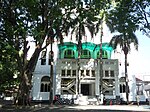
Jalan Jaksa (abbreviated as Jl. Jaksa) is a short street approximately 400 meters long at Menteng subdistrict in Central Jakarta, Indonesia. It is located about 1 km south of the national museum, Monas and west of the Gondangdia railway station. The street connects Jalan KH Wahid Hasyim to Jalan Kebon Sirih. The six-meter-wide road offers tourists the opportunity to get cheap accommodation, and used to be a hub for nightlife, however, for several years now the nightlife scene here has dwindled with tourists and locals gravitating towards newer areas. It was designed as the main choice of foreign as well as domestic backpackers who visited Jakarta until around 2016.

Excerpt from the Wikipedia article Jalan Jaksa (License: CC BY-SA 3.0, Authors, Images).

Jalan Jaksa
Gang Kebon Sirih Barat Dalam I No. 11, Special Capital Region of Jakarta Menteng (Central Jakarta)

Geographical coordinates (GPS) Address Nearby Places
placeShow on map

Wikipedia: Jalan JaksaContinue reading on Wikipedia

Geographical coordinates (GPS)

Latitude Longitude
N -6.186 ° E 106.829 °
placeShow on map

Address

Construction site

Gang Kebon Sirih Barat Dalam I No. 11
10340 Special Capital Region of Jakarta, Menteng (Central Jakarta)
Indonesia
mapOpen on Google Maps

Jalan Jaksa
Jalan Jaksa
Share experience

Nearby Places

North Jakarta
North Jakarta

North Jakarta (Indonesian: Jakarta Utara; Betawi: Jakarte Belilir) is one of the five administrative cities (kota administrasi) which form Special Capital Region of Jakarta, Indonesia. North Jakarta is not self-governed and does not have a city council, hence it is not classified as a proper municipality. It contains the entire coastal area within the Jakarta Special District. In North Jakarta, an area at the estuary of Ciliwung river was the main port for the kingdom of Tarumanegara, which later grew to become Jakarta. Many historic sites and artefacts of Jakarta can be found in North Jakarta. Both ports of Tanjung Priok and historic Sunda Kelapa are located in the city. The city, which covers an area of 139.99 km2, had 1,645,659 inhabitants at the 2010 census and 1,778,981 at the 2020 census. It has its administrative centre in Tanjung Priok. North Jakarta contains some of Jakarta's original natural mangrove forests. As the city has developed, some of this mangrove forest was converted into urban areas. However, a reforestation project aimed at planting mangroves within an area of 400 hectares was enacted in 2011 and was scheduled to be finished in 2012. The main goal of the project was to minimize abrasion in the coastal area, especially around the Pantai Indah Kapuk area.North Jakarta is bounded by Java Sea to the north; Bekasi to the east; West Jakarta, Central Jakarta and East Jakarta to the south; and Tangerang to the west.