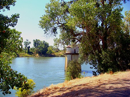
place

Sacramento River

Central Valley ProjectGeography of Sacramento, CaliforniaGeography of the Central Valley (California)Geography of the Sacramento ValleyHistory of Sacramento, California
Mendocino National ForestRivers of Butte County, CaliforniaRivers of Colusa County, CaliforniaRivers of Contra Costa County, CaliforniaRivers of Glenn County, CaliforniaRivers of Northern CaliforniaRivers of Sacramento County, CaliforniaRivers of Shasta County, CaliforniaRivers of Siskiyou County, CaliforniaRivers of Solano County, CaliforniaRivers of Sutter County, CaliforniaRivers of Tehama County, CaliforniaRivers of Yolo County, CaliforniaRivers of the San Francisco Bay AreaRivers with fish laddersSacramento RiverSacramento ValleySacramento–San Joaquin River DeltaSan Francisco Bay watershedShasta-Trinity National ForestTributaries of San Pablo BayUse American English from December 2022Use mdy dates from December 2022
Sacramento River
Sacramento River

The Sacramento River (Spanish: Río Sacramento) is the principal river of Northern California in the United States and is the largest river in California. Rising in the Klamath Mountains, the river flows south for 400 miles (640 km) before reaching the Sacramento–San Joaquin River Delta and San Francisco Bay. The river drains about 26,500 square miles (69,000 km2) in 19 California counties, mostly within the fertile agricultural region bounded by the Coast Ranges and Sierra Nevada known as the Sacramento Valley, but also extending as far as the volcanic plateaus of Northeastern California. Historically, its watershed has reached as far north as south-central Oregon where the now, primarily, endorheic (closed) Goose Lake rarely experiences southerly outflow into the Pit River, the most northerly tributary of the Sacramento. The Sacramento and its wide natural floodplain were once abundant in fish and other aquatic creatures, notably one of the southernmost large runs of chinook salmon in North America. For about 12,000 years, humans have depended on the vast natural resources of the watershed, which had one of the densest Native American populations in California. The river has provided a route for trade and travel since ancient times. Hundreds of tribes sharing regional customs and traditions have inhabited the Sacramento Valley, first coming into contact with European explorers in the late 1700s. The Spanish explorer Gabriel Moraga named the river Rio de los Sacramentos in 1808, later shortened and anglicized into Sacramento. In the 19th century, gold was discovered on a tributary of the Sacramento River, starting the California Gold Rush and an enormous population influx to the state. Overland trails such as the California Trail and Siskiyou Trail guided hundreds of thousands of people to the gold fields. By the late part of the century mining had ceased to be a major part of the economy, and many immigrants turned to farming and ranching. Many populous communities were established along the Sacramento River, including the state capital of Sacramento. Intensive agriculture and mining contributed to pollution in the Sacramento River, and significant changes to the river's hydrology and environment. Since the 1950s the watershed has been intensely developed for water supply and the generation of hydroelectric power. Today, large dams impound the river and almost all of its major tributaries. The Sacramento River is used heavily for irrigation and serves much of Central and Southern California through the canals of giant state and federal water projects. While it is now providing water to over half of California's population and supporting the most productive agricultural area in the nation, these changes have left the Sacramento greatly modified from its natural state and have caused the decline of its once-abundant fisheries.

Excerpt from the Wikipedia article Sacramento River (License: CC BY-SA 3.0, Authors, Images).

Geographical coordinates (GPS)

Latitude Longitude
N 38.063333333333 ° E -121.85277777778 °
placeShow on map

Address

Contra Costa County (Contra Costa)


California, United States
mapOpen on Google Maps

Sacramento River
Sacramento River
Share experience

Nearby Places

San Joaquin River
San Joaquin River

The San Joaquin River (; Spanish: Río San Joaquín) is the longest river of Central California. The 366-mile (589 km) long river starts in the high Sierra Nevada, and flows through the rich agricultural region of the northern San Joaquin Valley before reaching Suisun Bay, San Francisco Bay, and the Pacific Ocean. An important source of irrigation water as well as a wildlife corridor, the San Joaquin is among the most heavily dammed and diverted of California's rivers. People have inhabited the San Joaquin Valley for more than 8,000 years, and it was long one of the major population centers of pre-Columbian California. Starting in the late 18th century, successive waves of explorers then settlers, mainly Spanish and American, emigrated to the San Joaquin basin. When Spain colonized the area, they sent soldiers from Mexico, who were usually of mixed native Mexican and Spanish birth, led by Spanish officers. Franciscan missionaries from Spain came with the expeditions to evangelize the natives by teaching them about the Catholic faith. Once an inland sea, most of the San Joaquin Valley has a very uniform topography, and much of the lower river formed a huge flood basin. In the 20th century, many levees and dams were built on the San Joaquin and all of its major tributaries. These engineering works changed the fluctuating nature of the river forever, and cut off the Tulare Basin from the rest of the San Joaquin watershed. Once habitat for hundreds of thousands of spawning salmon and millions of migratory birds, today the river is subject to tremendous water-supply, navigation and regulation works by various federal agencies, which have dramatically reduced the flow of the river since the 20th century.

Sacramento–San Joaquin River Delta

The Sacramento–San Joaquin River Delta, or California Delta, is an expansive inland river delta and estuary in Northern California. The Delta is formed at the western edge of the Central Valley by the confluence of the Sacramento and San Joaquin rivers and lies just east of where the rivers enter Suisun Bay, which flows into San Francisco Bay, then the Pacific Ocean via San Pablo Bay. The Delta is recognized for protection by the California Bays and Estuaries Policy. Sacramento–San Joaquin Delta was designated a National Heritage Area on March 12, 2019. The city of Stockton is located on the San Joaquin River at the eastern edge of the delta. The total area of the Delta, including both land and water, is about 1,100 square miles (2,800 km2). Its population is around 500,000.The Delta was formed by rising sea level following glaciation, leading to the accumulation of Sacramento and San Joaquin River sediments behind the Carquinez Strait, the sole outlet from the Central Valley to San Pablo Bay. The narrowness of the Carquinez Strait coupled with tidal action has caused the sediment to pile up, forming expansive islands. Geologically, the Delta has existed for about 10,000 years, since the end of the Last Glacial Period. In its natural state, the Delta was a large freshwater marsh, consisting of many shallow channels and sloughs surrounding low islands of peat and tule. Since the mid-19th century, most of the region has been gradually claimed for agriculture. Wind erosion and oxidation have led to widespread subsidence on the Central Delta islands; much of the Delta region today sits below sea level, behind levees earning it the nickname "California's Holland". Much of the water supply for Central California and Southern California is also derived from the Delta, via pumps located at the southern end of the Delta. The pumps deliver water for irrigation in the San Joaquin Valley and municipal water supply for Southern California.