place

Browns Island (Contra Costa County)

East Bay Regional Park DistrictIslands of Contra Costa County, CaliforniaIslands of Northern CaliforniaIslands of Suisun BayIslands of the Sacramento–San Joaquin River Delta
Parks in Contra Costa County, CaliforniaPittsburg, CaliforniaUninhabited islands of California
Antioch aerial view, August 2018 cropped

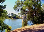
Browns Island (also Gwin Island or Brown Island) is a regional preserve of the East Bay Regional Park District (EBRPD) in Pittsburg, Contra Costa County, California, United States. It is an island in Suisun Bay, part of the Sacramento-San Joaquin River Delta, separated from the rest of Pittsburg by New York Slough. The 595-acre (241 ha) island is separated from Winter Island to the east by Middle Slough, and bounded by New York Slough on the south and Suisun Bay on the west and northwest. It is shown, labeled "Gwin Island", on an 1850 survey map of the San Francisco Bay area made by Cadwalader Ringgold and an 1854 map of the area by Henry Lange.The East Bay Regional Park District has published a guide to the wild plants that grow on this island. The island is home to six rare and endangered plant species, and a variety of aquatic birds.

Excerpt from the Wikipedia article Browns Island (Contra Costa County) (License: CC BY-SA 3.0, Authors, Images).

Browns Island (Contra Costa County)

Geographical coordinates (GPS) Address Nearby Places
placeShow on map

Wikipedia: Browns Island (Contra Costa County)Continue reading on Wikipedia

Geographical coordinates (GPS)

Latitude Longitude
N 38.03881 ° E -121.86468 °
placeShow on map

Address

Pittsburg


94565
California, United States
mapOpen on Google Maps

Antioch aerial view, August 2018 cropped
Share experience

Nearby Places

Sacramento River
Sacramento River

The Sacramento River (Spanish: Río Sacramento) is the principal river of Northern California in the United States and is the largest river in California. Rising in the Klamath Mountains, the river flows south for 400 miles (640 km) before reaching the Sacramento–San Joaquin River Delta and San Francisco Bay. The river drains about 26,500 square miles (69,000 km2) in 19 California counties, mostly within the fertile agricultural region bounded by the Coast Ranges and Sierra Nevada known as the Sacramento Valley, but also extending as far as the volcanic plateaus of Northeastern California. Historically, its watershed has reached as far north as south-central Oregon where the now, primarily, endorheic (closed) Goose Lake rarely experiences southerly outflow into the Pit River, the most northerly tributary of the Sacramento. The Sacramento and its wide natural floodplain were once abundant in fish and other aquatic creatures, notably one of the southernmost large runs of chinook salmon in North America. For about 12,000 years, humans have depended on the vast natural resources of the watershed, which had one of the densest Native American populations in California. The river has provided a route for trade and travel since ancient times. Hundreds of tribes sharing regional customs and traditions have inhabited the Sacramento Valley, first coming into contact with European explorers in the late 1700s. The Spanish explorer Gabriel Moraga named the river Rio de los Sacramentos in 1808, later shortened and anglicized into Sacramento. In the 19th century, gold was discovered on a tributary of the Sacramento River, starting the California Gold Rush and an enormous population influx to the state. Overland trails such as the California Trail and Siskiyou Trail guided hundreds of thousands of people to the gold fields. By the late part of the century mining had ceased to be a major part of the economy, and many immigrants turned to farming and ranching. Many populous communities were established along the Sacramento River, including the state capital of Sacramento. Intensive agriculture and mining contributed to pollution in the Sacramento River, and significant changes to the river's hydrology and environment. Since the 1950s the watershed has been intensely developed for water supply and the generation of hydroelectric power. Today, large dams impound the river and almost all of its major tributaries. The Sacramento River is used heavily for irrigation and serves much of Central and Southern California through the canals of giant state and federal water projects. While it is now providing water to over half of California's population and supporting the most productive agricultural area in the nation, these changes have left the Sacramento greatly modified from its natural state and have caused the decline of its once-abundant fisheries.

San Joaquin River
San Joaquin River

The San Joaquin River (; Spanish: Río San Joaquín) is the longest river of Central California. The 366-mile (589 km) long river starts in the high Sierra Nevada, and flows through the rich agricultural region of the northern San Joaquin Valley before reaching Suisun Bay, San Francisco Bay, and the Pacific Ocean. An important source of irrigation water as well as a wildlife corridor, the San Joaquin is among the most heavily dammed and diverted of California's rivers. People have inhabited the San Joaquin Valley for more than 8,000 years, and it was long one of the major population centers of pre-Columbian California. Starting in the late 18th century, successive waves of explorers then settlers, mainly Spanish and American, emigrated to the San Joaquin basin. When Spain colonized the area, they sent soldiers from Mexico, who were usually of mixed native Mexican and Spanish birth, led by Spanish officers. Franciscan missionaries from Spain came with the expeditions to evangelize the natives by teaching them about the Catholic faith. Once an inland sea, most of the San Joaquin Valley has a very uniform topography, and much of the lower river formed a huge flood basin. In the 20th century, many levees and dams were built on the San Joaquin and all of its major tributaries. These engineering works changed the fluctuating nature of the river forever, and cut off the Tulare Basin from the rest of the San Joaquin watershed. Once habitat for hundreds of thousands of spawning salmon and millions of migratory birds, today the river is subject to tremendous water-supply, navigation and regulation works by various federal agencies, which have dramatically reduced the flow of the river since the 20th century.