Sollentuna socken

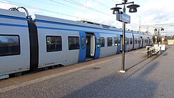
Sollentuna socken is a former socken of Sollentuna Hundred in Uppland, Sweden. The area largely corresponds to the modern Sollentuna Municipality, but not completely. Hansta was incorporated into Stockholm Municipality in 1980, while other localities (such as Silverdal) were incorporated into the municipality from other parishes. The parish encompassed an area of approximately 49.50 square kilometres (19.11 sq mi), whereof 46.08 square kilometres (17.79 sq mi) were land. Edsberg Castle, the seat farm of Sollentunaholm, the locality of Sjöberg, the municipal districts of Rotebro, Viby, Norrviken, Vaxmora, Häggvik, Edsberg, Tureberg, and Helenelund as well as Sollentuna Station and the parish church of Sollentuna were located in the parish.
Excerpt from the Wikipedia article Sollentuna socken (License: CC BY-SA 3.0, Authors, Images).Sollentuna socken
Klockargården, Sollentuna kommun
Geographical coordinates (GPS) Address Nearby Places Show on map
Geographical coordinates (GPS)
| Latitude | Longitude |
|---|---|
| N 59.466666666667 ° | E 17.918333333333 ° |
Address
Sollentuna kyrka
Klockargården
192 72 Sollentuna kommun
Sweden
Open on Google Maps


