place

Robin Hood's Ball

Archaeological sites in WiltshireCausewayed enclosuresScheduled monuments in WiltshireSites associated with StonehengeStone Age sites in Wiltshire
Use British English from December 2020

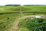
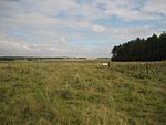
Robin Hood’s Ball is a Neolithic causewayed enclosure on Salisbury Plain in Wiltshire, England, approximately 5 miles (8 km) northwest of the town of Amesbury, and 2+1⁄2 miles (4.0 km) northwest of Stonehenge. The site was designated as a scheduled monument in 1965.

Excerpt from the Wikipedia article Robin Hood's Ball (License: CC BY-SA 3.0, Authors).

Robin Hood's Ball
Southern Transit,

Geographical coordinates (GPS) Address External links Nearby Places
placeShow on map

Wikipedia: Robin Hood's BallContinue reading on Wikipedia

Geographical coordinates (GPS)

Latitude Longitude
N 51.2128 ° E -1.855 °
placeShow on map

Address

Robin Hood's Ball

Southern Transit
SP4 8QR , Shrewton
England, United Kingdom
mapOpen on Google Maps

linkWikiData (Q7352474)
linkOpenStreetMap (36970535)

Share experience

Nearby Places

A344 road (England)
A344 road (England)

The A344 was an A road in the English county of Wiltshire. Until 2013 it ran from its junction with the A303 at Stonehenge, northwest to its junction with the A360, 2 miles (3 km) away. The A344 was once part of a longer route, from Andover (Hampshire) in the east to Warminster in the west. The section from Andover to Amesbury was redesignated as the A303 when the new route to the South West was created as an alternative to the A30. A 2-mile (3 km) section between Airman's Corner near Stonehenge and Shrewton was (sometime before 1958) shared with the re-routed A360. The western section, from Shrewton to Heytesbury near Warminster, has been re-classified as the B390. The remaining section passed close to Stonehenge. In July 2012, work began on a £27m project which involved the closure and grassing over of the A344 between Stonehenge Bottom and the monument, with the pedestrian underpass beneath the road being filled in. This section of road was eventually closed in June 2013. The new Stonehenge visitors' centre at Airman's Corner (or Airman's Cross) opened in December 2013. Vehicle traffic on the remaining short section of the A344 is now mostly shuttle buses between the Stonehenge visitors' centre and the monument. The bus service could not cope with demand during the fourth weekend after opening; long queues developed and many visitors chose to walk to the Stones rather than wait for the buses. Therefore, the A344 is no longer a road open to public vehicular access. As the closure of the section between Airman's Cross and Byway 12 was by means of a Traffic Regulation Order prohibiting motor vehicles, this section remains a public highway for non-motor vehicles, horses, bicycles, and pedestrians. A memorial to Major Alexander William Hewetson, of the 66th Battery Royal Field Artillery, stands beside the old A344 at Fargo Wood, west of Stonehenge. Major Hewetson was killed in an accident on 17 July 1913 during a training flight from Larkhill Aerodrome, shortly after the formation of the Royal Flying Corps. The memorial had originally stood at the junction of the A344 and A360 but was placed in storage and re-erected in its current location when the Stonehenge visitor centre opened.

Stonehenge Landscape

The Stonehenge Landscape is a property of The National Trust, located on Salisbury Plain in Wiltshire, England. The estate (formerly known as Stonehenge Historic Landscape and before that as Stonehenge Down) covers 2,100 acres (850 ha) surrounding the neolithic monument of Stonehenge, which is administered by English Heritage. Much of the land is designated open access by the Trust, including the fields immediately around Stonehenge and other fields that become available as part of the chalk grassland reversion project (see below). Stonehenge itself is in the care of English Heritage, having been given to the nation in 1918 by Cecil and Mary Chubb, who had bought it three years previously from the Antrobus family.Much of the land surrounding the stones was acquired in 1927 after a public appeal was launched to prevent further development on the fields around the monument. The successfully purchased land was given to the National Trust for the benefit of the nation. Shortly afterwards such structures as cottages and an old World War I aerodrome were removed from the immediate vicinity of the stones. There are two memorials to different fatal flying accidents in the area. Eustace Loraine and Staff Sergeant Wilson were killed in 1912 near to the new Stonehenge Visitors' centre. Major Hewetson was killed in a flying accident near Fargo Wood in July 1913. Later the Trust acquired more land, principally after the purchase of an adjacent farm in the early 21st century. The land owned by the Trust comprises almost one third of the Stonehenge World Heritage Site, and contains nearly 400 ancient monuments (most of them scheduled). These monuments include the enormous earthwork known as the Stonehenge Cursus, the Avenue, Woodhenge and Durrington Walls, as well as numerous burial mounds known as barrows. The estate also includes some of the Nile Clumps, large clumps of trees on arable farmland, said to represent ship positions at the Battle of the Nile. This is said to form a large memorial to Horatio Nelson, created by a local landowner after Nelson's death. During the 1970s and 1980s, the estate was the scene of the Stonehenge Free Festival. Damage to monuments such as the Cursus barrows was one of the reasons that the festival was banned in 1985. As part of the World Heritage Site Management Plan for Stonehenge, some 340 hectares of the land will revert to chalk grassland by 2011. The scheme (one of the largest reversion schemes of its kind in Europe) will turn over much of the estate to permanent pasture, and allow for increased open access around the area. At present some 112 hectares have reverted and, along with the existing grassland, are used as public open access as well as animal grazing.