Stonehenge Cursus
4th-millennium BC architectureArchaeological sites in WiltshireBarrows in EnglandBuildings and structures in WiltshireLinear earthworks ... and 8 more
National Trust properties in WiltshireRuins in WiltshireScheduled monuments in WiltshireSites associated with StonehengeStone Age sites in WiltshireUse British English from October 2013Vague or ambiguous time from July 2022World Heritage Sites in England

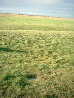
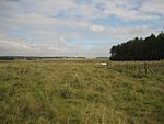
The Stonehenge Cursus (sometimes known as the Greater Cursus) is a large Neolithic cursus monument on Salisbury plain, near to Stonehenge in Wiltshire, England. It is roughly 3 kilometres (1.9 mi) long and between 100 metres (330 ft) and 150 metres (490 ft) wide. Excavations in 2007 dated the construction of the earthwork to between 3630 and 3375 BCE, several hundred years before the earliest phase of Stonehenge in 3000 BC. The cursus, along with adjacent barrows and the nearby 'Lesser Cursus' are part of the National Trust's Stonehenge Landscape property, and is within the Stonehenge and Avebury World Heritage Site.
Excerpt from the Wikipedia article Stonehenge Cursus (License: CC BY-SA 3.0, Authors, Images).Stonehenge Cursus
Byway 12,
Geographical coordinates (GPS) Address External links Nearby Places Show on map
Geographical coordinates (GPS)
| Latitude | Longitude |
|---|---|
| N 51.186 ° | E -1.826 ° |
Address
The Cursus
Byway 12
SP4 7DE , Amesbury
England, United Kingdom
Open on Google Maps


