place

Hordron Edge stone circle

Stone circles in Derbyshire
Hordron Edge stone circle geograph.org.uk 1365389

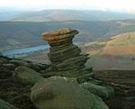
Hordron Edge stone circle, also known as 'The Seven Stones of Hordron' is a Bronze Age stone circle (grid reference SK2152486851) in Derbyshire, England. It is on the edge of Moscar Moor. Ladybower reservoir is to the west, and Moscar Cross is to the northeast. Seven stones are presently (2017) visible with a further three stones, now recumbent and hidden discovered in 1992. Some authorities believe that the circle might have once comprised 26 stones.The stone circle is approximately 15 to 16 m (49 to 52 ft) in diameter, with eleven stones between 45 cm and 95 cm high extant upright.

Excerpt from the Wikipedia article Hordron Edge stone circle (License: CC BY-SA 3.0, Authors, Images).

Hordron Edge stone circle
Manchester Road, High Peak Derwent

Geographical coordinates (GPS) Address Nearby Places
placeShow on map

Wikipedia: Hordron Edge stone circleContinue reading on Wikipedia

Geographical coordinates (GPS)

Latitude Longitude
N 53.378055555556 ° E -1.6780555555556 °
placeShow on map

Address

Hordron Edge Stone Circle

Manchester Road
S33 0AX High Peak, Derwent
England, United Kingdom
mapOpen on Google Maps

Hordron Edge stone circle geograph.org.uk 1365389
Share experience

Nearby Places

Birchinlee
Birchinlee

Birchinlee is the site of "Tin Town", a village built by the Derwent Valley Water Board for the workers (and their families) who constructed the Derwent and Howden Dams between 1902 and 1916. Most of the workers had previously been engaged in the construction, in Wales, of the Elan Valley Reservoirs where the accommodation was very basic. At Birchinlee, a "model village" was built; its infrastructure included hospitals, school, canteen (pub), post office, shops, recreation hall, public bath house, police station, railway station, rubbish dump with incinerator, and much else. One of the shops was a well-stocked store owned by the Gregory brothers from Tideswell. Accommodation consisted of workmen's huts, foremen's huts and married workmen's huts. The latter were decorated to a high standard, as photographs from the period confirm. The population rose to 900 people. Remnants of "Tin Town" can still be seen when walking to the west of Derwent Reservoir. The former railway track is now a footpath. One of the buildings was salvaged and rebuilt at Hope where in 2014 it was reported to be housing a beauty parlour.A number of books and resources charting the history of Birchinlee and the dambuilders have been written by Professor Brian Robinson (whose mother was born and lived in Tintown) and Doctor Bill Beven, Peak District National Park archaeologist. The Derwent Valley Museum, formerly located on the Derwent Reservoir dam and run privately by the late Vic Hallam, told the history of the Derwent valley and of Derwent, Ashopton and Birchinlee as well as the tale of RAF Squadron 617 and its training for Operation Chastise (the "Dam Busters" raids) during the Second World War.Further up the valley is Beavers Croft, a 14th-century housestead that was occupied by the chief engineer of Howden Dam in the early part of the 20th century. It is currently owned by private business partners that let the house for self-catering holidays during the summer, and the barn was occupied by a part-time PDNPA ranger until late 2013.