place

River Ashop

Derwent (Derbyshire) catchmentRivers and valleys of the Peak DistrictRivers of DerbyshireUse British English from September 2017
RiverAshop
RiverAshop

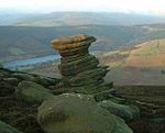
The River Ashop is a river in the Derbyshire Peak District, England. Its source is on the eastern slopes of Mill Hill, three miles south east of Glossop and just north of Kinder Scout. The river flows approximately ten kilometres east, following the Sheffield to Manchester Snake Pass road through remote countryside, before emptying into Ladybower Reservoir, which itself flows into the River Derwent. The only significant tributary of the River Ashop is the short River Alport. The flow of the Alport is partially diverted by a weir to feed into the Ashop above the impound weir built in the 1920s to increase the catchment area of the Derwent Reservoir prior to the building of the Ladybower Reservoir downstream. The weir impounded the water and fed it into an open culvert (water conduit) that was built along the side of the hill. The culvert then feeds into a siphon over the river in a 6-foot-diameter (1.8 m) iron pipe before entering a tunnel to pass through the hill to the Derwent Reservoir via an open watercourse, entering the reservoir just north of the dam wall. The concrete structure of the weir is visible when travelling up the Snake Pass route from Sheffield.

Excerpt from the Wikipedia article River Ashop (License: CC BY-SA 3.0, Authors, Images).

River Ashop
Snake Road, High Peak Hope Woodlands

Geographical coordinates (GPS) Address Nearby Places
placeShow on map

Wikipedia: River AshopContinue reading on Wikipedia

Geographical coordinates (GPS)

Latitude Longitude
N 53.372985 ° E -1.710658 °
placeShow on map

Address

Snake Road
S33 0BY High Peak, Hope Woodlands
England, United Kingdom
mapOpen on Google Maps

RiverAshop
RiverAshop
Share experience

Nearby Places

Birchinlee
Birchinlee

Birchinlee is the site of "Tin Town", a village built by the Derwent Valley Water Board for the workers (and their families) who constructed the Derwent and Howden Dams between 1902 and 1916. Most of the workers had previously been engaged in the construction, in Wales, of the Elan Valley Reservoirs where the accommodation was very basic. At Birchinlee, a "model village" was built; its infrastructure included hospitals, school, canteen (pub), post office, shops, recreation hall, public bath house, police station, railway station, rubbish dump with incinerator, and much else. One of the shops was a well-stocked store owned by the Gregory brothers from Tideswell. Accommodation consisted of workmen's huts, foremen's huts and married workmen's huts. The latter were decorated to a high standard, as photographs from the period confirm. The population rose to 900 people. Remnants of "Tin Town" can still be seen when walking to the west of Derwent Reservoir. The former railway track is now a footpath. One of the buildings was salvaged and rebuilt at Hope where in 2014 it was reported to be housing a beauty parlour.A number of books and resources charting the history of Birchinlee and the dambuilders have been written by Professor Brian Robinson (whose mother was born and lived in Tintown) and Doctor Bill Beven, Peak District National Park archaeologist. The Derwent Valley Museum, formerly located on the Derwent Reservoir dam and run privately by the late Vic Hallam, told the history of the Derwent valley and of Derwent, Ashopton and Birchinlee as well as the tale of RAF Squadron 617 and its training for Operation Chastise (the "Dam Busters" raids) during the Second World War.Further up the valley is Beavers Croft, a 14th-century housestead that was occupied by the chief engineer of Howden Dam in the early part of the 20th century. It is currently owned by private business partners that let the house for self-catering holidays during the summer, and the barn was occupied by a part-time PDNPA ranger until late 2013.

Win Hill
Win Hill

Win Hill is a hill north west of Bamford in the Derbyshire Peak District of England. Its summit is 462 m (1,516 ft) above sea level and it is bounded by the River Derwent to the east, the River Noe to the south west and Ladybower Reservoir to the north, with a ridge running north west linking it to Kinder Scout. The Roman road from Glossop over the Snake Pass crosses the ridge to the north and descends to Hope and the old Roman base of Brough in the Hope Valley, with the Hope Cross, a marker post dating from 1737, at the highest point of the road. On top of Win Hill lies Win Hill Pike, locally known as the Pimple. Win Hill Pike has an Ordnance Survey triangulation point, or trig point. Sometimes misnamed the Old Witches Knoll, Win Hill Pike is often used for a Duke of Edinburgh Award station. Win Hill is commonly ascended from Yorkshire Bridge or Hope. The ascent from Yorkshire Bridge is a steep climb of 300 metres (980 ft) in 1.2 km (3⁄4 mi) by Parkin Clough, first through woods then over the moor to the top. Routes from Hope are gentler, either via Twitchill Farm or the villages of Aston and Thornhill. Depending on direction of travel, Win Hill is either the first or last hill on the Derwent Watershed and Edale Horseshoe challenge walks. With around 144 m (472 ft) of relative height, Win Hill is only a few metres short of qualifying as a Marilyn. The hill's counterpart, Lose Hill, lies to the west on the opposite side of the River Noe. In relatively recent times, the two hills' names have prompted a fanciful tale concerning the outcome of an imagined 7th-century battle between the forces of Edwin of Northumbria and Cynegils of Wessex. Edwin's forces occupied Win Hill, while Cynegils' men camped on Lose Hill. As the battle progressed, Cynegils' forces advanced up Win Hill, and Edwin's retreated behind a temporary wall they had built near the summit. They pushed the boulders of the wall downhill, crushing the Wessex soldiers and gaining victory in the battle. However, there is no historical basis for the tale, and no evidence of any battle ever being fought here. A more prosaic explanation for the name is that Win Hill was originally recorded as Wythinehull, meaning "Withy Hill" or "Willow Hill". Fragments of willow can still be found in the otherwise largely coniferous plantation on the approach from Yorkshire Bridge.