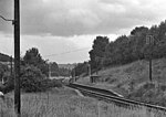
Rodborough Common, Gloucestershire

Rodborough Common is a 116.0-hectare (287-acre) biological and geological Site of Special Scientific Interest in Gloucestershire, notified in 1954. The site is listed in the ‘Stroud District’ Local Plan, adopted November 2005, Appendix 6 (online for download) as an SSSI and a Regionally Important Geological Site (RIGS). The Common is also a Special Area of Conservation (SAC) under the EU Habitats Directive Rodborough Common is sited south of Stroud and is owned and managed by the National Trust. It is north of Minchinhampton Common. It lies on Jurassic limestone and is on top of the Cotswold scarp. It is bounded on either side by the Nailsworth valley and the Frome valley. It is on a hill (a plateau area), and its margins are dissected by dry valleys. The sides of this plateau are steep.Rodborough Common, like Minchinhampton Common, is notified for its biological and geological importance. The grassland is unimproved, herb-rich and calcareous. There is an important geological area for fossils for research purposes.
Excerpt from the Wikipedia article Rodborough Common, Gloucestershire (License: CC BY-SA 3.0, Authors, Images).Rodborough Common, Gloucestershire
Moor Court,
Geographical coordinates (GPS) Address Nearby Places Show on map
Geographical coordinates (GPS)
| Latitude | Longitude |
|---|---|
| N 51.730465 ° | E -2.216418 ° |
Address
Rodborough Common
Moor Court
GL5 5GA , Minchinhampton
England, United Kingdom
Open on Google Maps


