Tyneside
AC with 0 elementsGeography of Tyne and WearNUTS 3 statistical regions of the United KingdomRiver TyneUrban areas of England

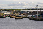
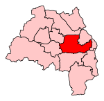
Tyneside is a built-up area across the banks of the River Tyne in northern England. Residents of the area are commonly referred to as Geordies. The whole area is surrounded by the North East Green Belt. The population of Tyneside as published in the 2011 census was 774,891, making it the eighth most-populous urban area in the United Kingdom. In 2013, the estimated population was 832,469.Politically, the area is mainly covered by the metropolitan boroughs of Newcastle-upon-Tyne, Gateshead, North Tyneside and South Tyneside. The boroughs on the Tyne are joint with Wearside which is in both the counties of Durham (Chester-le-Street) and Tyne and Wear.
Excerpt from the Wikipedia article Tyneside (License: CC BY-SA 3.0, Authors, Images).Tyneside
Hayhole Road, North Tyneside Percy Main
Geographical coordinates (GPS) Address Nearby Places Show on map
Geographical coordinates (GPS)
| Latitude | Longitude |
|---|---|
| N 54.9875 ° | E -1.4583333333333 ° |
Address
Hayhole Road
Hayhole Road
NE29 6XL North Tyneside, Percy Main
England, United Kingdom
Open on Google Maps


