MacArthur Causeway
1920 establishments in FloridaBeam bridges in the United StatesBridges completed in 1920Bridges of the United States Numbered Highway SystemCauseways in Miami-Dade County, Florida ... and 9 more
Concrete bridges in the United StatesGirder bridges in the United StatesIntracoastal WaterwayRoad bridges in FloridaRoads in MiamiRoads in Miami-Dade County, FloridaRoads in Miami Beach, FloridaU.S. Route 41Use mdy dates from January 2012

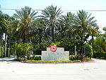
The General Douglas MacArthur Causeway is a six-lane causeway that connects Downtown Miami to South Beach via Biscayne Bay in Miami-Dade County. The highway is the singular roadway connecting the mainland and beaches to Watson Island and the bay neighborhoods of Palm Island, Hibiscus Island, and Star Island. The MacArthur Causeway carries State Road 836 and State Road A1A over the Biscayne Bay via a girder bridge. Interstate 395 ends at Fountain Street, the entrance to Palm Island Park which has a traffic light as well as bus stops.
Excerpt from the Wikipedia article MacArthur Causeway (License: CC BY-SA 3.0, Authors, Images).MacArthur Causeway
MacArthur Causeway, Miami Beach
Geographical coordinates (GPS) Address Nearby Places Show on map
Geographical coordinates (GPS)
| Latitude | Longitude |
|---|---|
| N 25.777777777778 ° | E -80.164444444444 ° |
Address
MacArthur Causeway
MacArthur Causeway
33139 Miami Beach
Florida, United States
Open on Google Maps


