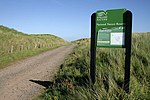
Holy Island Waggonway
Horse-drawn railwaysLimestone industryLindisfarneRailways on English Islands

The Holy Island Waggonway (sometimes referred to as the Holy Island Tramway) was a network of waggonways across the island of Lindisfarne, Northumberland, England. The earliest two lines connected limestone quarries at the northern end of the island with lime kilns and a tidal jetty in waters known as The Basin, northwest of Lindisfarne Priory. A third line down the eastern side of the island eventually replaced the earlier routes. It was built to connect the remaining quarry with new kilns and a pair of new jetties near Lindisfarne Castle. The waggonways had all fallen into disuse by the middle of the 1880s.
Excerpt from the Wikipedia article Holy Island Waggonway (License: CC BY-SA 3.0, Authors, Images).Holy Island Waggonway
Crooked Lonnen,
Geographical coordinates (GPS) Address Nearby Places Show on map
Geographical coordinates (GPS)
| Latitude | Longitude |
|---|---|
| N 55.68154 ° | E -1.78393 ° |
Address
Welcome to Lindisfarne National Nature Reserve
Crooked Lonnen
TD15 2SH , Holy Island
England, United Kingdom
Open on Google Maps


