Collinpark Wood SSSI

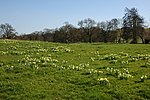
Collinpark Wood (grid reference SO750278) is a 66.69-hectare (164.8-acre) biological Site of Special Scientific Interest in Gloucestershire, notified in 1966, revised in 1974 and renotified in 1983. There was a boundary change in 1983. There are seven units of assessment. Unit 1 (grid reference SO747279) is a 15-hectare (37-acre) area owned and managed by the Gloucestershire Wildlife Trust. The trust purchased this part of the wood in 1979 with grant aid from WWF. The site is listed in the 'Forest of Dean Local Plan Review' as a Key Wildlife Site (KWS).The wood lies two miles north-east of Newent in rolling countryside near the River Leadon. The ancient woodland had been managed as coppice for many hundreds of years. Until the 1850s timber from it had been used to produce charcoal for the iron industry. The straight paths within the wood are likely to be tramways. Along the western edge of the wood owned by the Gloucestershire Wildlife Trust is a cutting and embankment. These are evidence of a failed attempt to build a railway line to link Worcester and the Forest of Dean coalfields.The wood is sited on Triassic Keuper Marl rocks. These produce acid soils and influence the flora and fauna of the area.
Excerpt from the Wikipedia article Collinpark Wood SSSI (License: CC BY-SA 3.0, Authors, Images).Collinpark Wood SSSI
Forest of Dean Upleadon
Geographical coordinates (GPS) Address Nearby Places Show on map
Geographical coordinates (GPS)
| Latitude | Longitude |
|---|---|
| N 51.948579 ° | E -2.364418 ° |
Address
GL18 1EE Forest of Dean, Upleadon
England, United Kingdom
Open on Google Maps


