Upleadon

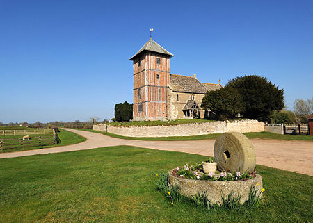
Upleadon is a village and civil parish situated 10.5 km north-west of Gloucester. Soon after the Norman conquest Upleadon became part of the estates of Gloucester Abbey and was recorded as such in the Domesday Book. Taking advantage of the nearby river, there was a period when iron forges were a focal point for the community but these were subsequently converted into a flour-mill. The village today extends southwards alongside the River Leadon and has a population of 213 according to the Gloucestershire County Council.Standing opposite the parish church, Upleadon Court is a large 18th-century farmhouse, but the asymmetry of its north front suggests that it was built around an older house. The lower timber-framed west wing was built in the late 16th or early 17th century. Several outbuildings also predate the main house.
Excerpt from the Wikipedia article Upleadon (License: CC BY-SA 3.0, Authors, Images).Upleadon
Forge Lane, Forest of Dean Upleadon
Geographical coordinates (GPS) Address Nearby Places Show on map
Geographical coordinates (GPS)
| Latitude | Longitude |
|---|---|
| N 51.93967 ° | E -2.35721 ° |
Address
Forge Lane
Forge Lane
GL18 1EG Forest of Dean, Upleadon
England, United Kingdom
Open on Google Maps


