Santo António, Macau

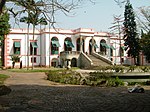
Santo António is a civil parish (Portuguese: freguesia) in the western portion of the Macau Peninsula of Macau. It has the highest population density in Macau (98,776 persons per km²). This parish was one of five in the former Municipality of Macau, one of Macau's two municipalities that were abolished on 31 December 2001 by Law No. 17/2001, following the 1999 transfer of sovereignty over Macau from Portugal to China. While their administrative functions have since been removed, these parishes are still retained nominally. It is north of the parish of Sé, south of Nossa Senhora de Fátima parish, west of São Lázaro parish, and east of the Inner Harbor (Porto Interior).
Excerpt from the Wikipedia article Santo António, Macau (License: CC BY-SA 3.0, Authors, Images).Santo António, Macau
田畔街 Rua de Entre-Campos,
Geographical coordinates (GPS) Address Nearby Places Show on map
 Continue reading on Wikipedia
 Geographical coordinates (GPS)
| Latitude | Longitude |
|---|---|
| N 22.2009 ° | E 113.542 ° |
Address
田畔新村 Vila Nova de Entre Campos
田畔街 Rua de Entre-Campos 21-25A
519020 , 新橋 Barca
Macau, China
Open on Google Maps