Port St. Lucie metropolitan area

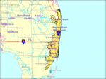
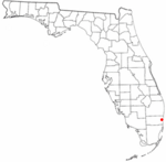
The Port St. Lucie, FL Metropolitan Statistical Area (MSA) includes St. Lucie and Martin counties in the Treasure Coast region of Florida. The MSA was defined by the Office of Management and Budget with its current composition in 1983 as the Ft. Pierce, FL MSA, with Fort Pierce as the principal city. The name was changed to Ft. Pierce-Port St. Lucie, FL MSA in 1992, with the addition of Port St. Lucie as a principal city. The name of the MSA was changed to Port St. Lucie-Ft. Pierce, FL MSA in 2003, and to Port St. Lucie, FL MSA in 2006, with the removal of Fort Pierce as a principal city. The Port St. Lucie MSA is included in the Miami-Port St. Lucie-Fort Lauderdale, FL Combined Statistical Area. The Port St. Lucie, FL MSA was included, together with the Sebastian-Vero Beach, FL MSA (consisting of Indian River County), in the Port St. Lucie-Sebastian-Vero Beach Combined Statistical Area (CSA), in December 2006. In February 2013, the Office of Management and Budget issued a bulletin that defined the Miami-Fort Lauderdale-Port St. Lucie CSA, which includes the Miami-Fort Lauderdale-West Palm Beach MSA, Okeechobee Micropolitan Statistical Area (μSA), Port St. Lucie MSA, and Sebastian-Vero Beach MSA. The Port St. Lucie-Sebastian-Vero Beach CSA was not listed in that bulletin, as its two components had been moved to the Miami-Fort Lauderdale-Port St. Lucie CSA.
Excerpt from the Wikipedia article Port St. Lucie metropolitan area (License: CC BY-SA 3.0, Authors, Images).Port St. Lucie metropolitan area
Northwest 8th Place,
Geographical coordinates (GPS) Address Nearby Places Show on map
Geographical coordinates (GPS)
| Latitude | Longitude |
|---|---|
| N 26.133333333333 ° | E -80.2 ° |
Address
Northwest 8th Place 3820
33311 , Lauderhill
Florida, United States
Open on Google Maps


