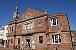
Wye Bridge Ward, Monmouth
Former wards of WalesMonmouth, Wales

Wye Bridge Ward was one of four wards in the town of Monmouth, Monmouthshire, Wales. Streets in the ward included St Mary's Street, Almshouse Street, St James Street, St James Square, Whitecross Street and Monk Street. The ward existed as a division of the town by the early seventeenth century, and continued into the twentieth century.
Excerpt from the Wikipedia article Wye Bridge Ward, Monmouth (License: CC BY-SA 3.0, Authors, Images).Wye Bridge Ward, Monmouth
St Mary's Street,
Geographical coordinates (GPS) Address Nearby Places Show on map
Geographical coordinates (GPS)
| Latitude | Longitude |
|---|---|
| N 51.8127 ° | E -2.7125 ° |
Address
St Mary's Street
NP25 3DD , Overmonnow
Wales, United Kingdom
Open on Google Maps


