Whitecross Street, Monmouth
Streets and squares in Monmouth, WalesTagged pages containing blacklisted linksUse British English from February 2017

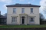
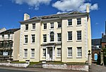
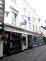
Whitecross Street is a historic street in the town centre of Monmouth, Monmouthshire, Wales. It was in existence by the 15th century, and appears as Whit crose on the 1610 map of the town by cartographer John Speed. It runs in an east-west direction, between Church Street and St James Square. It has been suggested that the street takes its name from a plague cross. Whitecross Street is lined with numerous listed buildings.
Excerpt from the Wikipedia article Whitecross Street, Monmouth (License: CC BY-SA 3.0, Authors, Images).Whitecross Street, Monmouth
Whitecross Street,
Geographical coordinates (GPS) Address Nearby Places Show on map
Geographical coordinates (GPS)
| Latitude | Longitude |
|---|---|
| N 51.8131 ° | E -2.7134 ° |
Address
Whitecross Street
NP25 3DT , Overmonnow
Wales, United Kingdom
Open on Google Maps


